Sayreville in Middlesex County, New Jersey — The American Northeast (Mid-Atlantic)
Sayreville United Methodist Church
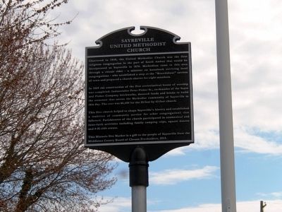
Photographed by Don Morfe, April 6, 2016
1. Sayreville United Methodist Church Marker
In 1869 the construction of the first ecclesiastical house of worship was completed. Industrialist Peter Fisher Sr., co-founder of the Sayre and Fisher Company brickworks, donated funds and bricks to build the structure that serves the Methodist community of Sayreville to this day. The cost was $6,600 for the 33 foot by 43 foot church.
This first church helped to shape Sayreville’s history and established a tradition of community service for other congregations that followed. Parishioners of the church participated in ecumenical and inter-faith activities including family camping trips, square dances and 4-H club events.
This Historic Site Marker is a gift to the people of Sayreville from the Middlesex County of Chosen
this page online
Topics. This historical marker is listed in this topic list: Religion & Religious Structures. A significant historical year for this entry is 1848.
Location. 40° 28.262′ N, 74° 21.094′ W. Marker is in Sayreville, New Jersey, in Middlesex County. It is on Main Street. Touch for map. Marker is at or near this postal address: 406 Main Street, Sayreville NJ 08872, United States of America. Touch for directions.

Regionally, this marker is in Central Jersey, in Greater Princeton, and in the New York City Metropolitan Area. It is also in the American Northeast, in the Mid-Atlantic, and on the Eastern Seaboard. Globally, it is in the North Atlantic Region, North America, the Western Hemisphere, the Western World, and the Anglosphere. Historically, it finds itself in what was once New Netherland and also one of the original Thirteen Colonies.
Other nearby markers. At least 8 other markers are within 3 miles of this marker, measured as the crow flies: Sayre & Fisher Reading Room (approx. 0.2 miles away); Sayre and Fisher Brick Water Tower (approx. 0.4 miles away); Sayreville, New Jersey Time Capsule (approx. ¾
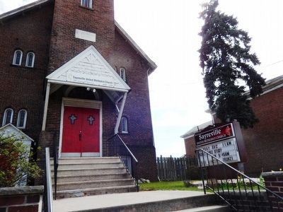
Photographed by Don Morfe, April 6, 2016
2. Sayreville United Methodist Church
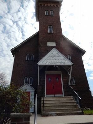
Photographed by Don Morfe, April 6, 2016
3. Sayreville United Methodist Church
Credits. This page was last revised on June 16, 2016. It was originally submitted on April 15, 2016, by Don Morfe of Baltimore, Maryland. This page has been viewed 509 times since then and 37 times this year. Photos: 1, 2, 3. submitted on April 15, 2016, by Don Morfe of Baltimore, Maryland. • Bill Pfingsten was the editor who published this page.
