Piedmont in Mineral County, West Virginia — The American South (Appalachia)
Mayo and Savage
Erected 2011 by West Virginia Archives and History.
Topics and series. This historical marker is listed in these topic lists: Colonial Era • Exploration. In addition, it is included in the West Virginia Archives and History series list. A significant historical year for this entry is 1736.
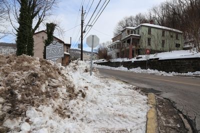
Location. 39° 28.783′ N, 79° 2.842′ W. Marker is in Piedmont, West Virginia, in Mineral County. Marker is at the intersection of Childs Avenue (West Virginia Route 46) and East Hampshire Street (West Virginia Route 46), on the left when traveling south on Childs Avenue. Touch for map. Marker is in this post office area: Piedmont WV 26750, United States of America. Touch for directions.
Other nearby markers. At least 8 other markers are within walking distance of this marker. Veterans Memorial (about 500 feet away, measured in a direct line); a different marker also named Veterans Memorial (about 500 feet away); Don Redman (approx. ¼ mile away); a different marker also named Veterans Memorial (approx. 0.4 miles away in Maryland); In Memoriam (approx. 0.6 miles away in Maryland); Our Honored Dead (approx. 0.6 miles away in Maryland); The Flood of September 1996 (approx. ¾ mile away in Maryland); Working Together for the Community (approx. 0.8 miles away in Maryland). Touch for a list and map of all markers in Piedmont.
Also see . . . Wikipedia entry for John Savage. John Savage was an 18th-century surveyor of colonial Virginia. He surveyed as part of a 1736 expedition to settle a boundary dispute between Lord Fairfax and the English Privy Council concerning the extent of the vast Northern Neck land grant.
In 1736, three different survey expeditions were organized with all three having representatives of both the Colony of Virginia and of Lord Fairfax. One party was to explore and map the Potomac to its head; this included Major William Mayo and Mr Brookes for the Colony (and King) and Mr Winslow and John Savage for Fairfax. A second party was to explore and map the North Branch of the Rappahannock (Mr Wood, Mr Thomas, Jr) and the final party was to explore and map the South Branches (Rapidan and Conway Rivers) of the Rappahannock (Mr Graeme, Mr Thomas, Sr).
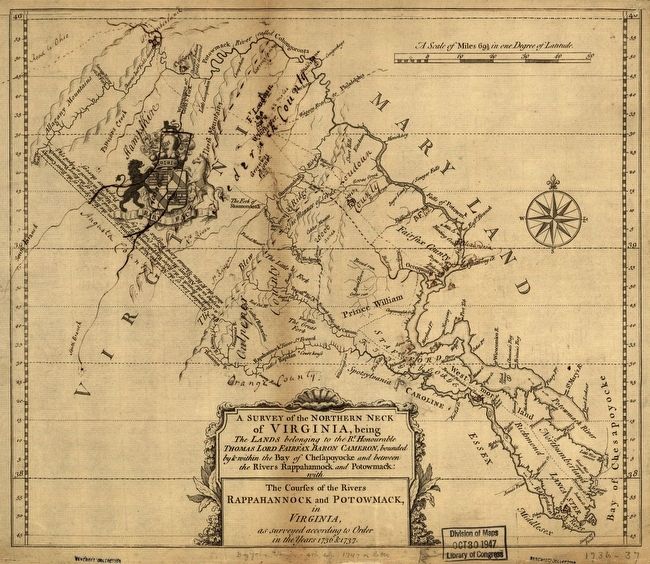
The work of the three groups and the county surveyors lead to the preparation of a map of the Northern Neck in 1736 and 1737. This map shows the courses of the Potomac and Rappahannock and cites latitudes across the map. What the map does not show, however, is a western boundary line for the grant. A line connecting the head springs of the Potomac with those of the Rappahannock had yet to be surveyed. This was to be the work of Colonel Peter Jefferson and Thomas Lewis — the “Fairfax Line” party — in 1746 and 1747, which finally settled the disputed claims. (Submitted on April 16, 2016.)

Library of Congress, approx 30 x 35 cm.
3. A Survey of the Northern Neck of Virginia
being The Lands belonging to the Right Honorable Thomas Lord Fairfax Baron Cameron, bounded by & within the Bay of Chesapoyocke and between the Rivers Rappahannock and Potowmack: with The courses of the Rivers Rappahannock and Potowmack, in Virginia, as surveyed according to Order in the Years 1836 & 1737.
Credits. This page was last revised on June 16, 2016. It was originally submitted on April 16, 2016, by J. J. Prats of Powell, Ohio. This page has been viewed 597 times since then and 38 times this year. Photos: 1, 2, 3. submitted on April 16, 2016, by J. J. Prats of Powell, Ohio.

