Williamsport in Burlington in Grant County, West Virginia — The American South (Appalachia)
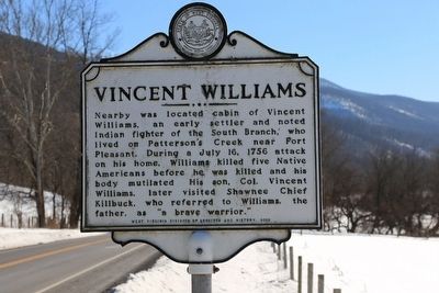
Vincent Williams
Erected 2002 by West Virginia Department of Archives and History.
Topics and series. This historical marker is listed in these topic lists: Settlements & Settlers • Wars, US Indian. In addition, it is included in the West Virginia Archives and History series list. A significant historical date for this entry is July 16, 1756.
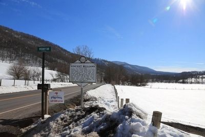
Location. 39° 12.648′ N, 79° 1.703′ W. Marker is in Burlington, West Virginia, in Grant County. It is in Williamsport. Marker is on Patterson Creek Road (County Route 5) 0.4 miles north of Williamsport-Twin Mountain Road (Local Road 5/2), on the left when traveling north. Touch for map. Marker is at or near this postal address: 18 Peony Dr, Old Fields WV 26845, United States of America. Touch for directions.
Other nearby markers. At least 8 other markers are within 8 miles of this marker, measured as the crow flies. High Knob (approx. 5.6 miles away); Nancy Hanks (approx. 5.9 miles away); Fort Pleasant (approx. 6.6 miles away); Willow Wall (approx. 6.7 miles away); Battle of Moorefield (approx. 6.9 miles away); Jarboe's Blockhouse (approx. 7˝ miles away); Greenland Gap (approx. 7.7 miles away); Greenland Gap Engagement (approx. 7.7 miles away).
Credits. This page was last revised on April 11, 2023. It was originally submitted on April 18, 2016, by J. J. Prats of Powell, Ohio. This page has been viewed 843 times since then and 40 times this year. Photos: 1, 2. submitted on April 18, 2016, by J. J. Prats of Powell, Ohio.

