South Side Flats in Pittsburgh in Allegheny County, Pennsylvania — The American Northeast (Mid-Atlantic)
Materials Handling
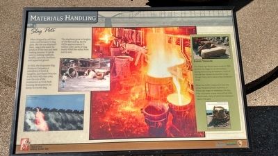
Slag Pots
— Rivers of Steel National Heritage Area —
In 1922, the Duquesne Slag Products Company, a subsidiary of Jones & Laughlin, purchased 94 acres in the Nine Mile Run Area, now the site of the Summerset at Frick Park housing development, to dump its excess slag.
The slag heap grew to heights of 150 feet and up. By the 1970s approximately 17 million cubic yards of slag nearly filled the valley from end to end.
Erected by Friends of the Riverfront, DCNR, National Park Service.
Topics. This historical marker is listed in this topic list: Industry & Commerce. A significant historical year for this entry is 1922.
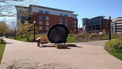
Location. 40° 25.705′ N, 79° 57.797′ W. Marker is in Pittsburgh, Pennsylvania, in Allegheny County. It is in the South Side Flats. Marker can be reached from the intersection of Three Rivers Heritage Trail and South 28th Street. Located on the Three Rivers Heritage Trail on Pittsburgh's South Side, just northeast of the Hyatt Hotel. Touch for map. Marker is in this post office area: Pittsburgh PA 15203, United States of America. Touch for directions.
Other nearby markers. At least 8 other markers are within walking distance of this marker. The MonCon Railroad (a few steps from this marker); Open Hearth Steel (within shouting distance of this marker); Rivers of Steel (about 300 feet away, measured in a direct line); Cast Iron Columns (about 500 feet away); Making Steel The J&L Way (about 600 feet away); Shaping Steel (about 700 feet away); Hub of Activity (approx. 0.2 miles away); Jones & Laughlin Steel Company (approx. 0.2 miles away). Touch for a list and map of all markers in Pittsburgh.
Credits. This page was last revised on February 2, 2023. It was originally submitted on April 21, 2016, by Mike Wintermantel of Pittsburgh, Pennsylvania. This page has been viewed 385 times since then and 20 times this year. Photos: 1, 2. submitted on April 21, 2016, by Mike Wintermantel of Pittsburgh, Pennsylvania.

