Upper Tract in Pendleton County, West Virginia — The American South (Appalachia)
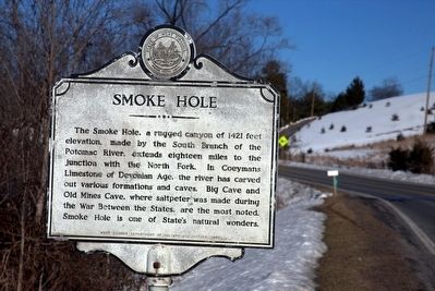
Smoke Hole
Erected 1989 by West Virginia Department of Culture and History.
Topics and series. This historical marker is listed in these topic lists: Landmarks • Notable Places. In addition, it is included in the West Virginia Archives and History series list.
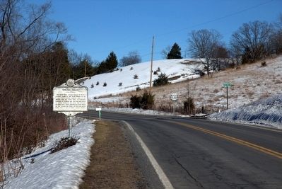
Location. 38° 48.936′ N, 79° 15.838′ W. Marker is in Upper Tract, West Virginia, in Pendleton County. Marker is on U.S. 220, 2.4 miles north of Upper Tract, on the left when traveling north. Touch for map. Marker is in this post office area: Upper Tract WV 26866, United States of America. Touch for directions.
Other nearby markers. At least 8 other markers are within 6 miles of this marker, measured as the crow flies. A different marker also named Smoke Hole (approx. 0.9 miles away); Eagle Rocks (approx. 1.7 miles away); Fort Upper Tract (approx. 2.2 miles away); St. George’s Church (approx. 3.1 miles away); Old Judy Church (approx. 4.4 miles away); Sites Homestead (approx. 6 miles away); A Melting Pot House (approx. 6.1 miles away); 10th Mountain Division (approx. 6.1 miles away). Touch for a list and map of all markers in Upper Tract.
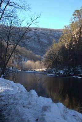
Also see . . . Wikipedia Entry. “The area is rather isolated and remote with parts accessible only by boat or on foot. Defined to the east by Cave Mountain and to the west by North Fork Mountain, Smoke Hole has been part of the Monongahela National Forest’s Spruce Knob-Seneca Rocks National Recreation Area since 1965, although some of it is still private land. Formerly the area was home to a scattered community of family homesteads, storied for their isolation, traditional lifestyles, and skilled production of the illicit liquor known as ‘moonshine.’ Today, The Nature Conservancy considers Smoke Hole and the surrounding mountains to be ‘one of the most biologically rich places in the East,’ especially as regards its rare plant communities. It included the Canyon as part of the greater Smoke Hole-North Mountain Bioreserve during its ‘Last Great Places’ campaign.” (Submitted on April 23, 2016.)
Credits. This page was last revised on June 16, 2016. It was originally submitted on April 23, 2016, by J. J. Prats of Powell, Ohio. This page has been viewed 383 times since then and 17 times this year. Photos: 1, 2, 3. submitted on April 23, 2016, by J. J. Prats of Powell, Ohio.
Editor’s want-list for this marker. Photos of the canyon with trees in leaf • Can you help?


