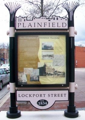
The Development of Downtown Plainfield
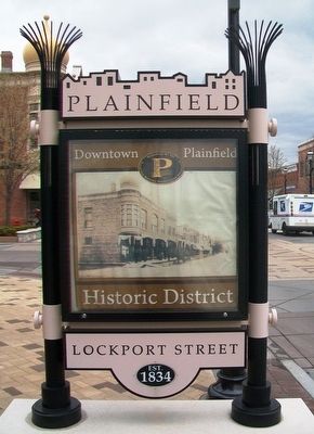
Downtown Plainfield Historic District
First Plat of "Planefield"
Chester Ingersoll platted the "Town of Planefield" in August 1834 north of the settlement at Walker's Grove. It was a modified grid plan of thirteen nearly square blocks with a formal Public Square at the intersection of Fox River Street and Lockport Street. Originally, Ingersoll envisioned businesses located around the public square; however, within a decade a central business district along what was known as the "Lockport Road" emerged. Until the 1870s, this roadway was known as DuPage Street; it is today's Lockport Street.
Ingersoll's town included the southern half of DuPage Street while Levi Arnold owned the northern half of it. Unlike Ingersoll's orderly blocks, Arnold allowed individuals to build haphazardly on his land while he retained ownership of it. Following Arnold's death in 1845, his wife and daughters formally platted this haphazard development as Arnold's Addition.
Commercial Area Forms
The commercial district along Lockport Street initially formed with Isaiah Clippinger dividing and selling lots in the front yard of his residence located on on [sic] the south side of DuPage Street between Illinois and Des Plaines Streets. About the same time, and on the north side of the street, George Bennitt moved twelve buildings from various lots around Plainfield and
In the 1850s and 1860s, Congregationalists, Baptists, Methodists, and Universalists constructed churches. The Plymouth Congregational Church, Sharon United Methodist, and Plainfield United Methodist remain in the downtown today.
The northern and southern portions of Plainfield were united as a single community in April 1869. The Village of Plainfield was incorporated under the general law of the State of Illinois on June 30, 1877.
[Inset photo captions read]
[Top right of marker]
Fires between 1881 and 1898 destroyed most of the early wooden structures along Lockport Street between Illinois and Des Plaines Street. After, the buildings were typically constructed of brick in [an] attempt to minimize the risk of fire.
Top left: North side of Lockport Street prior to the fires of the 1880s and 1890s.
Bottom left: The south side of Lockport Street after the fire of 1898.
[Large photo at bottom right]
The Masonic Block building was designed by J.E. Minett, an Aurora architect, and was constructed in 1892.
[Bottom left photos]
Early photographs and postcards of Plainfield churches. From left, St. Mary's Church, the Universalist
Topics and series. This historical marker is listed in these topic lists: Churches & Religion • Industry & Commerce • Settlements & Settlers. In addition, it is included in the Unitarian Universalism (UUism) series list. A significant historical month for this entry is August 1834.
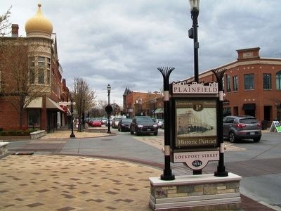
Location. 41° 36.512′ N, 88° 12.317′ W. Marker is in Plainfield, Illinois, in Will County. Marker is at the intersection of Lockport Street and Des Plaines Street, on the right when traveling west on Lockport Street. Touch for map. Marker is at or near this postal address: 24102 Lockport Street, Plainfield IL 60544, United States of America. Touch for directions.
Other nearby markers. At least 8 other markers are within walking distance of this marker. Downtown Historic District (a few steps from this marker); Masonic Block Building Landmark (within shouting distance of this marker); Opera House Block Building Landmark (about 400 feet away, measured in a direct line); Plainfield Congregational Meeting House (about 500 feet away); Plymouth Congregational Church (about 600 feet away); Overman-Brown-Buss Residence (approx. 0.2 miles away); Brownson-Martin House (approx. 0.2 miles away); Plainfield House (approx. 0.2 miles away). Touch for a list and map of all markers in Plainfield.
Also see . . .
1. Plainfield, Illinois. Encyclopedia of Chicago website
2. Downtown Plainfield Historic District National Register Registration. NPGallery: Digital Asset Management System website entry (Submitted on April 23, 2016, by William Fischer, Jr. of Scranton, Pennsylvania.)
Credits. This page was last revised on August 2, 2021. It was originally submitted on April 23, 2016, by William Fischer, Jr. of Scranton, Pennsylvania. This page has been viewed 410 times since then and 35 times this year. Photos: 1, 2, 3. submitted on April 23, 2016, by William Fischer, Jr. of Scranton, Pennsylvania.


