
Castries, Saint Lucia — Caribbean Region (Lesser Antilles)
Government House Saint Lucia
Photographed by J. Makali Bruton, April 10, 2016
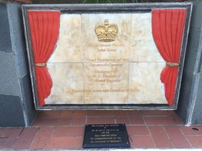
1. Government House Saint Lucia Marker
Governor-General
Designed by
Mr. C. Messervy
Colonial Engineer
Foundation stone laid October 15, 1894
Smaller marker:
This plaque was unveiled
by
HRH The Duke of York KCVO, ADC
on the
22nd February 2004
in commemoration of the
25th Anniversary of Independence
Erected 2004.
Topics. This historical marker is listed in this topic list: Government & Politics. A significant historical date for this entry is October 15, 1894.
Location. 14° 0.326′ N, 60° 59.835′ W. Marker is in Castries. It is on Government House Road, on the left when traveling north. Touch for map. Marker is in this post office area: Castries LC04 301, Saint Lucia. Touch for directions.

Regionally, it is one of the Lesser Antilles on the Caribbean Sea, on in the Atlantic Ocean, in North America, in the Western Hemisphere, and in the Anglosphere. Historically, it finds itself in what was once a British colony.
Other nearby markers. At least 8 other markers are within walking distance of this marker: World Wars Memorial (approx. 0.8 kilometers away); Sir William Arthur Lewis (approx. 0.8 kilometers away); Hon. Derek Alton Walcott (approx. 0.8
this page online
Photographed by J. Makali Bruton, April 10, 2016
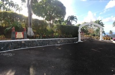
2. Government House Saint Lucia Marker
The entry gates to the residence are to the right.
Photographed by J. Makali Bruton, April 10, 2016
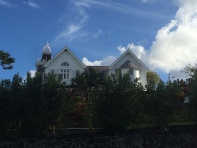
3. The Government House of Saint Lucia
A partial view of the house from the steeply inclined Government House Road.
Credits. This page was last revised on August 21, 2024. It was originally submitted on April 24, 2016, by J. Makali Bruton of Washington, District of Columbia. This page has been viewed 452 times since then and 17 times this year. Photos: 1, 2, 3. submitted on April 24, 2016, by J. Makali Bruton of Washington, District of Columbia.
