El Cerrito in Contra Costa County, California — The American West (Pacific Coastal)
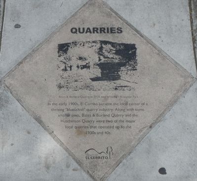
Quarries
Photographed by Barry Swackhamer, April 21, 2016
1. Quarries Marker
Caption: Bates & Borland Quarry in 1920, east of today's Arlington Park.
Erected by City of El Cerrito.
Topics and series. This historical marker is listed in this topic list: Industry & Commerce. In addition, it is included in the California - El Cerrito - San Pablo Avenue Historical-Cultural Pavers series list.
Location. 37° 55.1′ N, 122° 18.822′ W. Marker is in El Cerrito, California, in Contra Costa County. It is on San Pablo Avenue near Madison Avenue, on the left when traveling east. Touch for map. Marker is at or near this postal address: 11135 San Pablo Avenue, El Cerrito CA 94530, United States of America. Touch for directions.

Regionally, this marker is in the San Francisco Bay Area and on the Coast Ranges. It is also on the American Pacific Coast. Globally, it is in North America, on the Ring of Fire, on the Pacific Rim, in the Western Hemisphere, in the Western
this page online
Other nearby markers. At least 8 other markers are within walking distance of this marker: The Industrial Core (within shouting distance of this marker); Holy Ghost Festa (within shouting distance of this marker); Little Italy (approx. 0.2 miles away); Streetcars in El Cerrito (approx. 0.2 miles away); Contra Costa Civic Theatre (approx. 0.2 miles away); Stege Sanitary (approx. 0.2 miles away); Corridors of Change (approx. 0.2 miles away); City Hall (approx. 0.2 miles away). Touch for a list and map of all markers in El Cerrito.
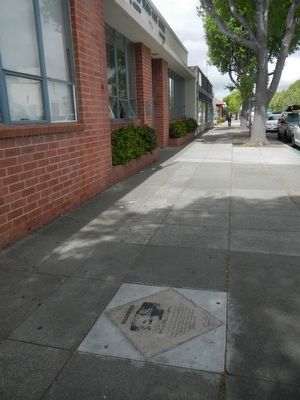
More about this marker. This marker is across the San Pablo Avenue from the northwest corner of Madison Avenue, in front of the post office.
This marker is one of The City of El Cerrito's Historical-Cultural Pavers.
Photographed by Barry Swackhamer, April 21, 2016
2. Quarries Marker
Credits. This page was last revised on June 16, 2016. It was originally submitted on April 25, 2016, by Barry Swackhamer of Brentwood, California. This page has been viewed 749 times since then and 38 times this year. Photos: 1, 2. submitted on April 25, 2016, by Barry Swackhamer of Brentwood, California.
