Jeffersonville in Cambridge in Lamoille County, Vermont — The American Northeast (New England)
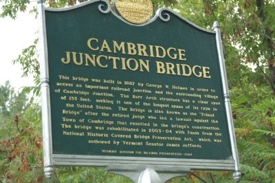
Cambridge Junction Bridge
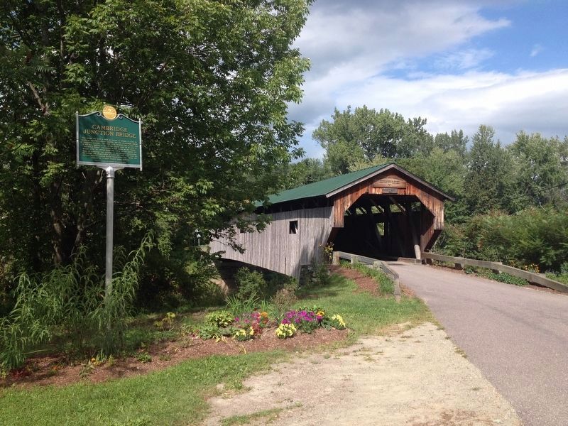
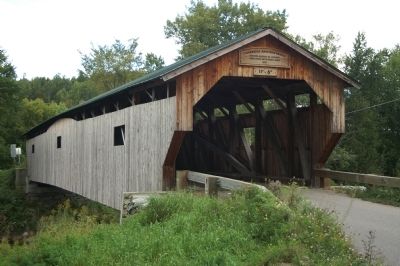
This bridge was built in 1887 by George W. Holmes in order to access an important railroad junction and the surrounding village of Cambridge Junction. The Burr Arch structure has a clear span of 135 feet, making it one of the longest spans of its type in the United States. The bridge is also known as the "Poland Bridge" after the retired judge who led a lawsuit against the Town of Cambridge that resulted in the bridge's construction. The bridge was rehabilitated in 2003-04 with funds from the National Historic Covered Bridge Preservation Act, which was authored by Vermont Senator James Jeffords.
Erected 2004 by Vermont Division for Historic Preservation.
Topics and series. This historical marker is listed in this topic list: Bridges & Viaducts. In addition, it is included in the Covered Bridges series list. A significant historical year for this entry is 1887.
Location. 44° 39.047′ N, 72° 48.881′ W. Marker is in Cambridge, Vermont, in Lamoille County. It is in Jeffersonville. Marker is on Cambridge Junction Road, 0.1 miles north of Grand Army of the Republic Highway (State Route 15), on the left when traveling north. Touch for map. Marker is in this post office area: Jeffersonville VT 05464, United States of America. Touch for directions.
Other nearby markers. At least 8 other markers are within 9 miles of this marker, measured as the crow flies. Cambridge Rail Era History I (within shouting distance of this marker); Cambridge Rail Era History II (within shouting distance of this marker); G.A.R. Cambridge, VT (approx. 3.1 miles away); Julian Scott (approx. 6.4 miles away); Town of Johnson World War and Spanish War Honor Roll (approx. 6˝ miles away); Town of Johnson Civil War Honor Roll (approx. 6˝ miles away); Mount Mansfield Natural Area (approx. 8.4 miles away); George Washington Henderson (approx. 8.8 miles away). Touch for a list and map of all markers in Cambridge.
Related markers. Click here for a list of markers that are related to this marker. Other Burr Truss Bridges on HMDB.org
Also see . . . Burr Truss. Wikipedia entry (Submitted on July 13, 2022, by Larry Gertner of New York, New York.)
Credits. This page was last revised on February 16, 2023. It was originally submitted on November 20, 2012, by Steve Bergeron of Milton, Vermont. This page has been viewed 642 times since then and 25 times this year. Last updated on April 29, 2016, by Dennis Gilkenson of Saxtons River, Vermont. Photos: 1. submitted on November 20, 2012, by Steve Bergeron of Milton, Vermont. 2. submitted on September 11, 2016, by Kevin Craft of Bedford, Quebec. 3. submitted on November 20, 2012, by Steve Bergeron of Milton, Vermont. • Kevin W. was the editor who published this page.


