Cape Henlopen State Park near Lewes in Sussex County, Delaware — The American Northeast (Mid-Atlantic)
The Osprey
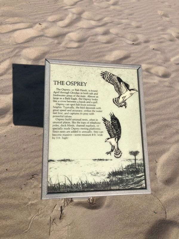
The Osprey or Fish Hawk is found April through October in both salt and freshwater areas of the state. Almost as large as a Bald Eagle, the Osprey looks like a cross between a hawk and a gull.
Osprey can spot fish from extreme heights. Typically, the bird descends with great speed and accuracy, strikes the water feet first, and captures its prey with powerful talons.
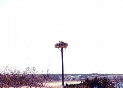
Osprey build unusual nests, often in unusual places, like the tops of telephone poles, duck blinds, channel markers, or specially made Osprey nesting platforms. Since nests are added to annually, they can become massive –some measure 8 ft. wide by 5 ft. high.
Topics. This historical marker is listed in this topic list: Animals.
Location. 38° 47.721′ N, 75° 5.516′ W. Marker is near Lewes, Delaware, in Sussex County. It is in Cape Henlopen State Park. It is on Post Road. The marker is located at the point of Cape Henlopen State Park. Touch for map. Marker is in this post office area: Lewes DE 19958, United States of America. Touch for directions.

Regionally, this marker is on Delaware’s Beaches. It
this page online
Other nearby markers. At least 8 other markers are within walking distance of this marker: Delaware’s Beachnesters (here, next to this marker); The Ever Changing Cape Henlopen (a few steps from this marker); Battery Hunter (approx. half a mile away); Senator David B. McBride (approx. 0.7 miles away); William J. Hopkins (approx. 0.8 miles away); Delaware Breakwater Quarantine Station (approx. 0.8 miles away); Quarantine Station (approx. 0.8 miles away); German Submarine at Cape Henlopen (approx. 0.8 miles away). Touch for a list and map of all markers in Lewes.
Additional commentary.
1. About this sign
While nature signs that do not interpret human history are no longer included in the Database, this one was originally filed prior to that change.
— Submitted April 30, 2024, by Devry Becker Jones of Washington, District of Columbia.
Photographed by Don Morfe, April 4, 1999
3. Osprey Platform
Credits. This page was last revised on April 30, 2024. It was originally submitted on April 29, 2016, by Don Morfe of Baltimore, Maryland. This page has been viewed 473 times since then and 12 times this year. Photos: 1, 2. submitted on May 17, 2020, by Devry Becker Jones of Washington, District of Columbia. 3. submitted on April 29, 2016, by Don Morfe of Baltimore, Maryland. • Bill Pfingsten was the editor who published this page.
