Belmopan, Cayo, Belize — Central America
Harriot W. Topsey
Photographed by J. Makali Bruton, May 2, 2016
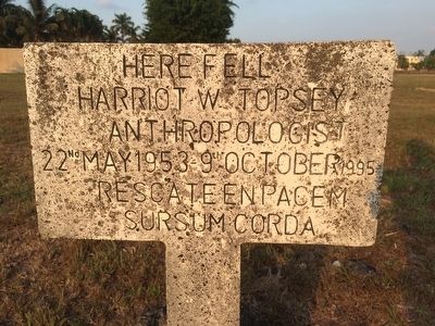
1. Harriot W. Topsey Marker
Harriot W. Topsey
Anthropologist
22nd May 1953 - 9th October 1995
Rescate en pacem
Sursum corda
Topics. This historical marker is listed in this topic list: Anthropology & Archaeology. A significant historical date for this entry is May 22, 1953.
Location. 17° 15.135′ N, 88° 46.518′ W. Marker is in Belmopan, Cayo. It is at the intersection of Constitution Drive and North Ring Road on Constitution Drive. Touch for map. Marker is in this post office area: Belmopan, Cayo 7L1TJ KV7TL, Belize. Touch for directions.

Regionally, it is in North America, Central America, Mesoamerica, the Western Hemisphere, and the Anglosphere. Historically, it finds itself in what was once New Spain, a Spanish colony, and specifically a British colony.
Other nearby markers. At least 6 other markers are within 5 kilometers of this marker, measured as the crow flies: Olmec Colossal Head (within shouting distance of this marker); The Flag of Belize (approx. 0.3 kilometers away); Belize's 10th Anniversary of Independence (approx. 0.4 kilometers away); Rt. Hon. George C. Price (approx. 1.6 kilometers away); Founding of Belmopan (approx. 2.3
this page online
Regarding Harriot W. Topsey. Harriot Wentworth Topsey was the first native Belizean archaeologist and its second archaeology commissioner. He passed away tragically when his vehicle went into this deep ditch here in Belmopan. It is not known why this marker chooses to describe him as an anthropologist, which would have seemed to be a minor role to his major role as archaeologist.
The latin phrase is roughly translated as "Rest in peace, lift up your hearts."
Photographed by J. Makali Bruton, May 2, 2016
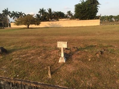
2. Harriot W. Topsey Marker
The Mexican Embassy can be seen in the background.
Credits. This page was last revised on July 2, 2017. It was originally submitted on May 2, 2016, by J. Makali Bruton of Washington, District of Columbia. This page has been viewed 1,092 times since then and 104 times this year. Photos: 1, 2. submitted on May 2, 2016, by J. Makali Bruton of Washington, District of Columbia.
