Chance, Saint John, Dominica — Caribbean Region of the Americas (Lesser Antilles of the West Indies)
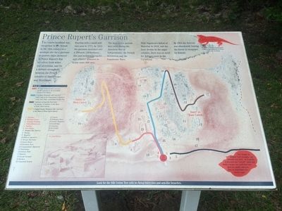
Prince Rupert's Garrison
The Cabrits headland was recognized by the British in the 18th century as a strategic site for a garrison to protect ships anchored in Price Rupert's Bay to collect fresh water and provisions, and for a defence stronghold between French colonies of Guadeloupe and Martinique.
Starting with a small military post in 1771, by 1815 the garrison stretched over a 200-acre (80-hectare) site and included barracks and officers' quarters to house some 600 men.
The most active periods here were during the American War of Independence, the French Revolution and the Napoleonic Wars.
With Napoleon's defeat at Waterloo in 1815, and the later decline in the sugar colonies, there was no need for defence posts in the Caribbean.
By 1854 the fortress was abandoned, leaving the forest to recapture its domain.
Site map and trail key
When does the Tree Lizard or Zanndoll extend the fold of skin on its throat into a fan?
· When it wants to keep cool
· When defending its territory
· During courtship
The Hermit or Soldier Crab occupies any suitable sea shell. As it grows, it discards the "rented" shell and finds a larger one until that one gets too small! And yes, they do sometimes use bottle caps!
Look for the Silk Cotton Tree with its flying buttresses and arm-like branches.
Topics. This historical marker is listed in these topic lists: Environment • Forts and Castles. A significant historical year for this entry is 1771.
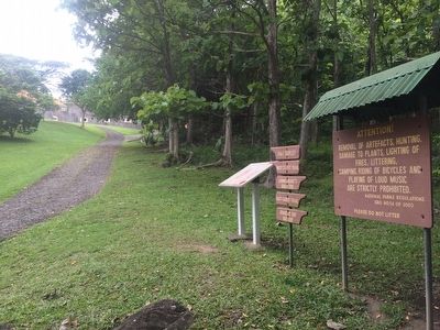
Location. 15° 35.046′ N, 61° 28.349′ W. Marker is in Chance, Saint John. Marker can be reached from Bay Street. The marker is near the reconstructed Fort Shirley on the walking trail towards the fort. Touch for map. Touch for directions.
Other nearby markers. At least 8 other markers are within walking distance of this marker. The Trees Return (within shouting distance of this marker); Fort Shirley (about 90 meters away, measured in a direct line); Guard House, Powder Magazine (about 120 meters away); Cabrits Calendar of Events (about 120 meters away); Water Catchment, Troops' Kitchen, Stables (about 120 meters away); Cabrits National Park (about 150 meters away); Officers' Quarters (about 150 meters away); Upper Battery, Signal Station (about 180 meters away). Touch for a list and map of all markers in Chance.
Credits. This page was last revised on June 16, 2016. It was originally submitted on May 6, 2016, by J. Makali Bruton of Accra, Ghana. This page has been viewed 300 times since then and 8 times this year. Photos: 1, 2. submitted on May 6, 2016, by J. Makali Bruton of Accra, Ghana.

