Manteo in Dare County, North Carolina — The American South (South Atlantic)
Andrew Cartwright
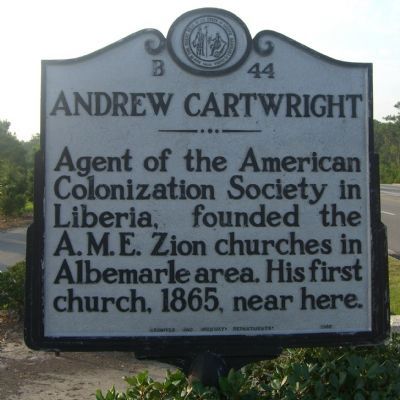
Photographed by Kevin W., July 22, 2008
1. Andrew Cartwright Marker
Erected 1965 by Archives and Highway Departments. (Marker Number B-44.)
Topics and series. This historical marker is listed in these topic lists: Religion & Religious Structures • Settlements & Settlers. In addition, it is included in the African Methodist Episcopal Zion (AME Zion) Church, and the North Carolina Division of Archives and History series lists. A significant historical year for this entry is 1865.
Location. 35° 53.426′ N, 75° 39.701′ W. Marker is in Manteo, North Carolina, in Dare County. It is at the intersection of North Virginia Dare Avenue (U.S. 64/264) and Russel Twiford Road, on the right when traveling west on North Virginia Dare Avenue. Touch for map. Marker is in this post office area: Manteo NC 27954, United States of America. Touch for directions.

Regionally, this marker is in the Coastal Plain and on the Outer Banks. It is also in the American South, specifically in the Upper South, in the Tidewater, and on the Eastern Seaboard. Globally,
this page online
Other nearby markers. At least 8 other markers are within one mile of this marker, measured as the crow flies: Mothervine Scuppernong Grape Arbor (about 300 feet away, measured in a direct line); History behind the Land of the Trail (about 400 feet away); The Collins Trail (about 400 feet away); Battle of Roanoke Island (about 500 feet away); Burnside Expedition of 1862 (approx. half a mile away); Red Wolf Country (approx. half a mile away); Bowser Family Cemetery (approx. half a mile away); Roanoke Island (approx. one mile away). Touch for a list and map of all markers in Manteo.
Additional keywords. African Methodist Episcopal Zion Church, AME Zion Church, Black Methodism
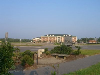
Photographed by Kevin W., July 22, 2008
2. Andrew Cartwright Marker
Credits. This page was last revised on November 28, 2019. It was originally submitted on July 22, 2008. This page has been viewed 2,429 times since then and 55 times this year. Photos: 1, 2. submitted on July 22, 2008, by Kevin W. of Stafford, Virginia.
