Waco in McLennan County, Texas — The American South (West South Central)
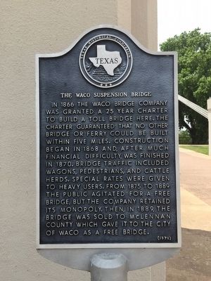
The Waco Suspension Bridge
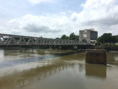
In 1866 the Waco Bridge Company was granted a 25 year charter to build a toll bridge here. The charter guaranteed that no other bridge or ferry could be built within five miles. Construction began in 1868 and, after much financial difficulty, was finished in 1870. Bridge traffic included wagons, pedestrians, and cattle herds. Special rates were given to heavy users. From 1875 to 1889 the public agitated for a free bridge, but the company retained its monopoly. Then, in 1889, the bridge was sold to McLennan County which gave it to the city of Waco as a free bridge.
Erected 1976 by Texas Historical Commission. (Marker Number 5448.)
Topics. This historical marker is listed in these topic lists: Bridges & Viaducts • Roads & Vehicles. A significant historical year for this entry is 1866.
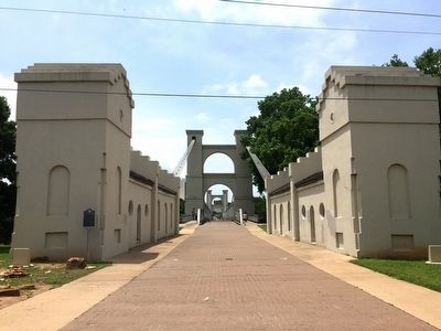
Location. 31° 33.726′ N, 97° 7.584′ W. Marker is in Waco, Texas, in McLennan County. Marker can be reached from Martin Luther King, Jr. Boulevard east of Washington Avenue, on the right when traveling west. Marker is located at the northeast end of the Waco Suspension Bridge in Doris D. Miller Park. Touch for map. Marker is in this post office area: Waco TX 76704, United States of America. Touch for directions.
Other nearby markers. At least 8 other markers are within walking distance of this marker. Going Up The Chisholm Trail (here, next to this marker); Washington Avenue Bridge at Brazos River (about 400 feet away, measured in a direct line); Jacob de Cordova (about 700 feet away); Waco Spring (about 700 feet away); a different marker also named Waco Suspension Bridge (approx. 0.2 miles away); a different marker also named The Waco Suspension Bridge (approx. 0.2 miles away); Veterans Plaza (approx. 0.2 miles away); Vietnam Veterans Memorial (approx. 0.2 miles away). Touch for a list and map of all markers in Waco.
More about this marker. There is an identical marker at the southwest end of the bridge.
Also see . . . Waco Suspension Bridge. From the Texas State Historical Association’s “Handbook of Texas Online”. (Submitted on May 17, 2016.)
Credits. This page was last revised on December 21, 2022. It was originally submitted on May 17, 2016, by Duane Hall of Abilene, Texas. This page has been viewed 630 times since then and 32 times this year. Photos: 1, 2, 3. submitted on May 17, 2016, by Duane Hall of Abilene, Texas.


