Sabinal in Uvalde County, Texas — The American South (West South Central)
Sabinal
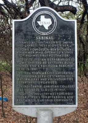
Photographed by William F Haenn, March 8, 2016
1. Sabinal Marker
Named by Spanish for Rio Sabina and Cypress trees along river.
Town founded in 1854 by Thomas B. Hammer who operated a stage shop and was first postmaster.
Despite Indian depredations, town thrived as settlers built homes, and a railroad reached here in 1881.
In 1906, town was incorporated. Telephone service started, city water works and volunteer fire department organized.
In 1907, Sabinal Christian College was founded. Closed in 1917.
Cotton industry was foremost in early 1900s. Today, farming and ranching flourish in community.
Erected 1967 by State Historical Survey Committee. (Marker Number 4425.)
Topics and series. This historical marker is listed in this topic list: Settlements & Settlers. In addition, it is included in the San Antonio-El Paso Road series list. A significant historical year for this entry is 1854.
Location. 29° 19.094′ N, 99° 27.603′ W. Marker is in Sabinal, Texas, in Uvalde County. It is on Fisher Ave East (U.S. 90) 0.3 miles east of Austin Street, on the right when traveling east. Touch for map. Marker is in this post office area: Sabinal TX 78881, United States of America.
this page online

Regionally, this marker is in the Hill Country. It is also in the American Borderlands. Globally, it is in North America, a Gulf of Mexico state, the Western Hemisphere, the Western World, and the Anglosphere. Historically, it finds itself in what was once New Spain, the Republic of Texas, and one of the Confederate States of America.
Other nearby markers. At least 8 other markers are within 11 miles of this marker, measured as the crow flies: John M. Davenport (here, next to this marker); The Sabinal Wait Station (approx. 0.4 miles away); Sabinal Methodist Church (approx. half a mile away); First Baptist Church of Sabinal (approx. 0.6 miles away); Site of Camp Sabinal (approx. 1.4 miles away); D'Hanis Brick and Tile Company (approx. 10.6 miles away); Emmanuel Lutheran Church (approx. 10.8 miles away); Town of Knippa (approx. 10.8 miles away). Touch for a list and map of all markers in Sabinal.
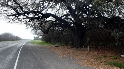
Photographed by William F Haenn, March 8, 2016
2. Sabinal Marker Location
Credits. This page was last revised on December 3, 2024. It was originally submitted on May 18, 2016, by William F Haenn of Fort Clark (Brackettville), Texas. This page has been viewed 3,701 times since then and 229 times this year. Photos: 1, 2. submitted on May 18, 2016, by William F Haenn of Fort Clark (Brackettville), Texas. • Bernard Fisher was the editor who published this page.
