
Maumee in Lucas County, Ohio — The American Midwest (Great Lakes)
Lucas County Children's Home
| — | Ohio Historical Marker | — |
Photographed by Dale K. Benington, May 18, 2016
1. Lucas County Children's Home Marker
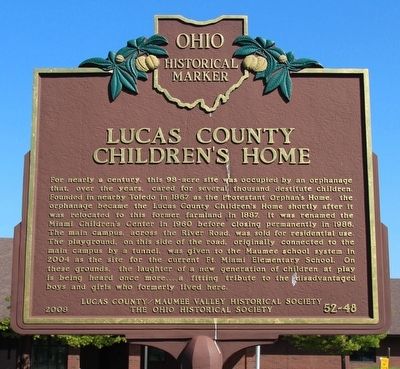
For nearly a century, this 98-acre site was occupied by an orphanage that, over the years, cared for several thousand destitute children. Founded in nearby Toledo in 1867 as the Protestant Orphan's Home, the orphanage became the Lucas County Children's Home shortly after it was relocated to this former farmland in 1887. It was renamed the Miami Children's Center in 1960 before closing permanently in 1986. The main campus, across the River Road, was sold for residential use. The playground, on this side of the road, originally connected to the main campus by a tunnel, was given to the Maumee school system in 2004 as the site for the current Ft. Miami Elementary School. On these grounds, the laughter of a new generation of children at play is being heard once more....a fitting tribute to the disadvantaged boys and girls who formerly lived here.
Erected 2008 by Lucas County/Maumee Valley Historical Society, and The Ohio Historical Society. (Marker Number 52-48.)
Topics and series. This historical marker is listed in these topic lists: Charity & Public Work • Education. In addition, it is included in the
this page online
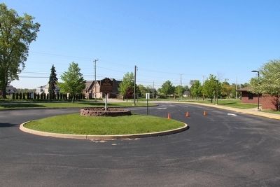
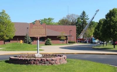
Location. 41° 34.682′ N, 83° 37.1′ W. Marker is in Maumee, Ohio, in Lucas County. It is on River Road north of Carew Lane, on the right when traveling south. This marker is located in the center of a small traffic island, in the middle if a student drop-off circle, at the Fort Miami Elementary School. Touch for map. Marker is at or near this postal address: 2501 River Rd, Maumee OH 43537, United States of America. Touch for directions.

Regionally, this marker is on the Lake Erie Shore and in the Toledo Metropolitan Area. It is also in the American Midwest and in the Corn Belt. Globally, it is in North America, on the Great Lakes, in the Western Hemisphere, in the Western World, and in the Anglosphere. Historically, it finds itself in what was once the Viceroyalty of New France, the Haudenosaunee (Iroquois) Confederacy, the territory of the Mississippian Culture, and the Northwest Territory.
Other nearby markers. At least 8 other markers are within walking distance of this marker: The Great Trail (approx. 0.3
Photographed by Dale K. Benington, May 18, 2016
2. Lucas County Children's Home Marker
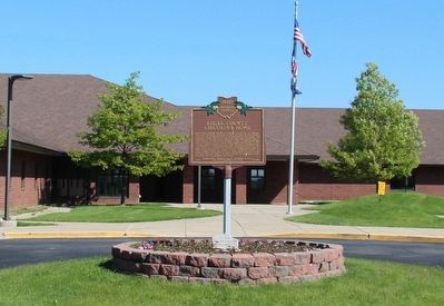
View of the marker, looking west, with the school in the background.
Other markers no longer nearby. to Hull's Crossing / to River Raisin (was approx. 0.3 miles away but has been confirmed missing); The Indian Wars (was approx. 0.6 miles away but has been permanently removed); Fort Miamis (was approx. 0.6 miles away but has been permanently removed); a different marker also named Fort Miamis (was approx. 0.6 miles away but has been permanently removed); British Betray Indian Allies (was approx. 0.6 miles away but has been permanently removed); Site of Fort Miami (was approx. 0.6 miles away but has been confirmed missing).
Photographed by Dale K. Benington, May 18, 2016
3. Lucas County Children's Home Marker
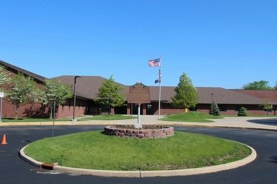
A more distant view of the marker situated on a traffic island, looking west, with the school in the background.
Photographed by Dale K. Benington, May 18, 2016
4. Lucas County Children's Home Marker
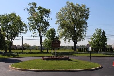
View of the marker, looking east, with a view of what use to be the main grounds of the Miami Children Center just across the street in the background.
Photographed by Dale K. Benington, May 18, 2016
5. Lucas County Children's Home Marker
View of the marker, looking southeast, situated in the center of a traffic island, in the middle of the school's student drop-off, drive through.
Photographed by Dale K. Benington, May 18, 2016
6. Lucas County Children's Home Marker
View of the marker in the foreground, with the school in the background, along with a view of the students enjoying an outdoor education activity, courtesy of the Maumee Fire Department.
Credits. This page was last revised on June 16, 2016. It was originally submitted on May 19, 2016, by Dale K. Benington of Toledo, Ohio. This page has been viewed 4,190 times since then and 355 times this year. Photos: 1, 2, 3, 4, 5, 6. submitted on May 19, 2016, by Dale K. Benington of Toledo, Ohio.
