
Richmond in Contra Costa County, California — The American West (Pacific Coastal)
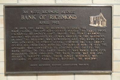
Bank of Richmond
201 West Richmond Avenue
| — | April 1902 | — |
Photographed by Barry Swackhamer, May 19, 2016
1. Bank of Richmond Marker
Erected by Point Richmond History Association.
Topics. This historical marker is listed in this topic list: Industry & Commerce.
Location. 37° 55.576′ N, 122° 23.162′ W. Marker is in Richmond, California, in Contra Costa County. It is at the intersection of West Richmond Avenue and Washington Avenue, on the left when traveling east on West Richmond Avenue. Touch for map. Marker is at or near this postal address: 201 West Richmond Avenue, Richmond
this page online

Regionally, this marker is in California’s San Francisco Bay Area and on the Coast Ranges. It is also on the American Pacific Coast. Globally, it is in North America, on the Ring of Fire, in the Pacific Rim, in the Western Hemisphere, in the Western World, and in the Anglosphere. Historically, it finds itself in what was once New Spain and also Mexico’s Alta California.
Other nearby markers. At least 8 other markers are within walking distance of this marker: First City Hall of Richmond (a few steps from this marker); The Critchett Hotel (a few steps from this marker); The Richmond Supply Company Building (within shouting distance of this marker); Women's Westside Improvement Club (about 300 feet away, measured in a direct line); "The Sentinel" (about 400 feet away); Our Lady of Mercy Church (about 400 feet away); By Land and By Sea (approx. 0.4 miles away); El Toro (approx. 0.6 miles away). Touch for a list and map of all markers in Richmond.
Photographed by Barry Swackhamer, May 19, 2016
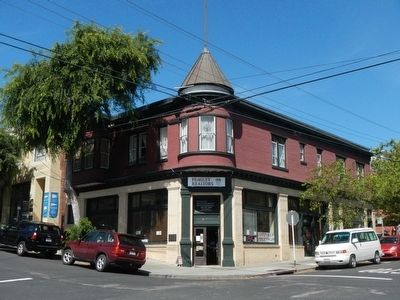
2. Bank of Richmond Building and Marker
Credits. This page was last revised on June 16, 2016. It was originally submitted on May 20, 2016, by Barry Swackhamer of Brentwood, California. This page has been viewed 636 times since then and 25 times this year. Photos: 1, 2. submitted on May 20, 2016, by Barry Swackhamer of Brentwood, California.
