New Middletown in Mahoning County, Ohio — The American Midwest (Great Lakes)
The Western Reserve
Southeast Boundary
| — | One of a Series of Four | — |
Photographed by Rev. Ronald Irick, September 26, 2012
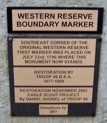
1. The Western Reserve Marker
This is the replacement plaque. The original was destroyed.
Erected 1966 by Troop 46 B.S.A. BFI Eagle Scout Daniel Shobel.
Topics. This historical marker is listed in these topic lists: Settlements & Settlers • War, US Revolutionary. A significant historical date for this entry is September 11, 1786.
Location. 40° 59.264′ N, 80° 31.146′ W. Marker is in New Middletown, Ohio, in Mahoning County. It is at the intersection of State Line Road and Felger Road (County Route 233), on the right when traveling south on State Line Road. Marker is surrounded by landfill operations. Touch for map. Marker is at or near this postal address: 9320 Stateline Rd, New Middletown OH 44442, United States of America. Touch for directions.

Regionally, this marker is in the Western Reserve and in the Mahoning Valley. It is also in the American Midwest. Globally, it is in North America,
this page online
Other nearby markers. At least 8 other markers are within 4 miles of this marker, measured as the crow flies: Quaker Falls (approx. 2.4 miles away in Pennsylvania); a different marker also named Quaker Falls (approx. 2.4 miles away in Pennsylvania); a different marker also named Quaker Falls (approx. 2.4 miles away in Pennsylvania); Burton Powder Company (approx. 2.4 miles away in Pennsylvania); Mahoning Township Veterans Memorial (approx. 2½ miles away in Pennsylvania); Lowellville Veterans Park (approx. 3½ miles away); The Mahoning River on Display (approx. 3½ miles away); Lowellville Veterans Memorial (approx. 3½ miles away).
Additional keywords. Connecticut Western Reserve
Photographed by Rev. Ronald Irick
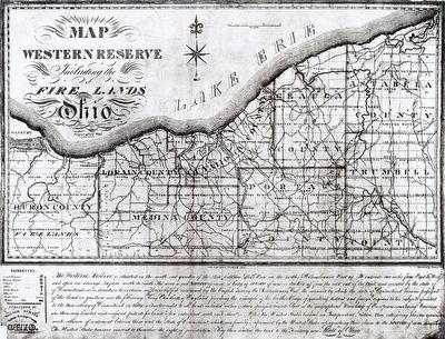
2. The Western Reserve Marker
Map of the Connecticut Western Reserve. This marker would be at the lower right, or southeast corner.
Photographed by Craig Doda, July 2, 2022
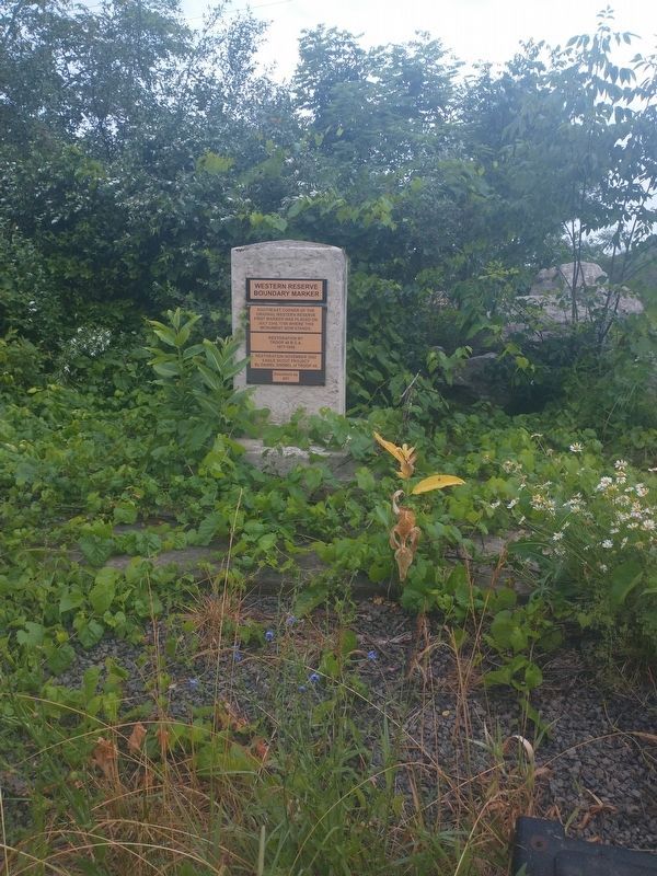
3. The Western Reserve Marker

Photographed by Jimmy Emerson, 2022
4. The Western Reserve Marker
The road marks the Ohio Pennsylvania state line.
Credits. This page was last revised on April 20, 2026. It was originally submitted on May 20, 2016, by Rev. Ronald Irick of West Liberty, Ohio. This page has been viewed 979 times since then and 63 times this year. Photos: 1, 2. submitted on May 20, 2016, by Rev. Ronald Irick of West Liberty, Ohio. 3. submitted on July 12, 2022, by Craig Doda of Napoleon, Ohio. 4. submitted on April 16, 2026, by Jimmy Emerson of Dalton, Georgia. • Bill Pfingsten was the editor who published this page.
