Near Enoree in Spartanburg County, South Carolina — The American South (South Atlantic)
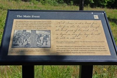
The Main Event
The battle's intensity grew, particularly here, where the Provincials were able to advance within ten yards of the Patriot line. However, before they could get any closer, the British commander, Lieutenant Colonel Alexander Innes, was wounded, triggering the retreat of his forces.
[In script]"… Col. Innes is at a house four miles from this, his wound through the back part of his neck… I am in hopes in very few days he will be able to ride out." – John H. Cruger to Lord Cornwallis, August 27, 1780. When the British commander was wounded on this field, his troops fled the battle.
Erected by South Carolina State Park Service.
Topics. This historical marker is listed in this topic list: War, US Revolutionary. A significant historical date for this entry is August 19, 1780.
Location. 34° 36.097′ N, 81° 51.033′ W. Marker is near Enoree, South Carolina, in Spartanburg County. Marker can be reached from Horseshoe Falls Road (State Highway S-42-10) 1.4 miles south of State Highway 56, on the left when traveling south. This marker is one of a series along the Musgrove Mill Battlefield Trail. The trail starts at a parking area and leads to a loop where the main battle action occurred. This marker is in the loop section approximately 4950 feet from the start of the trail. Touch for map. Marker is in this post office area: Enoree SC 29335, United States of America. Touch for directions.
Other nearby markers. At least 8 other markers are within walking distance of this marker. Ready for the Enemy (a few steps from this marker); Captain Shadrach Inman Memorial (a few steps from this marker); Bloody Chaos (within shouting distance of this marker); The Trap Is Sprung (about 300 feet away, measured in a direct line); The Enemy Within (about 400 feet away); Winning the Battle & the War (about 600 feet away); In Hot Pursuit (about 700 feet away); Inman's Men Bait the Trap (approx. 0.2 miles away). Touch for a list and map of all markers in Enoree.
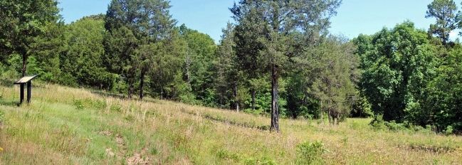
More about this marker. This part of the trail is at the edge of a clearing on a ridge where the American militiamen formed their battle line.
Regarding The Main Event. Illustration at lower left: "The Patriots held the strategic advantages of high ground and protective cover, leaving the British unable to get close enough to use their superior force."
Additional keywords. Musgrove.s Mill
Credits. This page was last revised on June 16, 2016. It was originally submitted on June 4, 2016, by David Graff of Halifax, Nova Scotia. This page has been viewed 331 times since then and 16 times this year. Photos: 1, 2. submitted on June 4, 2016, by David Graff of Halifax, Nova Scotia. • Bernard Fisher was the editor who published this page.

