Near Notasulga in Macon County, Alabama — The American South (East South Central)
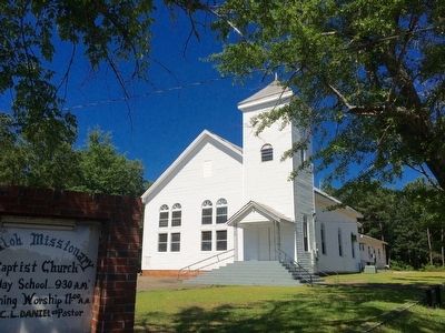
Shiloh Missionary Baptist Church - Church Privies
Inscription.
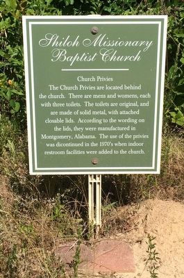
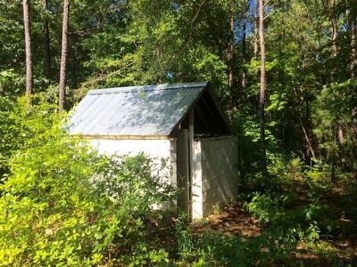
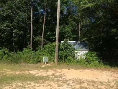
The Church Privies are located behind the church. There are mens and womens, each with three toilets. The toilets are original, and are made of solid metal, with attached closable lids. According to the wording on the lids, they were manufactured in Montgomery, Alabama. The use of the privies was discontinued in the 1970's when indoor restroom facilities were added to the church.
Erected by the Shiloh Community Restoration Foundation.
Topics. This historical marker is listed in this topic list: Churches & Religion.
Location. 32° 31.671′ N, 85° 40.643′ W. Marker is near Notasulga, Alabama, in Macon County. Marker can be reached from the intersection of Tuskegee Street (Alabama Route 81) and Shiloh Street, on the right when traveling north. Touch for map. Marker is at or near this postal address: Tuskegee Street, Notasulga AL 36866, United States of America. Touch for directions.
Other nearby markers. At least 8 other markers are within 5 miles of this marker, measured as the crow flies. Shiloh Missionary Baptist Church - Baptismal (a few steps from this marker); Shiloh Missionary Baptist Church "The Tree" (within shouting distance of this marker); Shiloh-Rosenwald School / Shiloh Missionary Baptist Church (about 300 feet away, measured in a direct line); Camp Watts (approx. half a mile away); Shiloh Missionary Baptist Church Cemetery (approx. 0.7 miles away); Birthplace of Zora Neale Hurston (approx. 2.7 miles away); Bethlehem (approx. 2.9 miles away); Battle of Chehaw Station (approx. 4.2 miles away). Touch for a list and map of all markers in Notasulga.
Related markers. Click here for a list of markers that are related to this marker.
Also see . . . The Shiloh Community. (Submitted on June 10, 2016, by Mark Hilton of Montgomery, Alabama.)
Credits. This page was last revised on June 16, 2016. It was originally submitted on June 9, 2016, by Mark Hilton of Montgomery, Alabama. This page has been viewed 427 times since then and 23 times this year. Photos: 1, 2, 3, 4. submitted on June 10, 2016, by Mark Hilton of Montgomery, Alabama.


