Holbrook in Navajo County, Arizona — The American Mountains (Southwest)
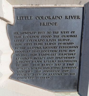
Little Colorado River Bridge
Photographed by Bill Kirchner, May 21, 2016
1. Little Colorado River Bridge Marker
Topics. This historical marker is listed in this topic list: Bridges & Viaducts. A significant historical year for this entry is 1928.
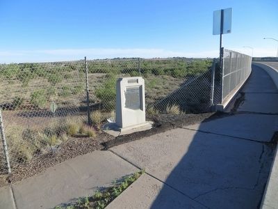
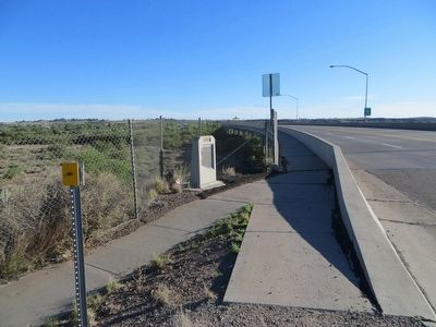
Location. 34° 53.644′ N, 110° 9.61′ W. Marker is in Holbrook, Arizona, in Navajo County. It is on U.S. 180, on the right when traveling south. Marker is at the southwest corner of the bridge. Touch for map. Marker is in this post office area: Holbrook AZ 86025, United States of America. Touch for directions.

Regionally, this marker is in Hopi. It is also in the American Southwest, in the Mountain West, on the Colorado Plateau, and at the Four Corners. Globally, it is in North America, the Western Hemisphere, the Western World, and the Anglosphere. Historically,
this page online
Other nearby markers. At least 7 other markers are within 13 miles of this marker, measured as the crow flies: Historic Wagon Road (approx. half a mile away); Sidney Sapp House (approx. half a mile away); Navajo County Courthouse (approx. 0.6 miles away); Wigwam Village #6 (approx. ¾ mile away); Henry R. Holbrook (approx. 0.8 miles away); The Old Fort (approx. 10.1 miles away); Historic Woodruff Snowflake Bridge (approx. 12.8 miles away).
Photographed by Bill Kirchner, May 21, 2016
2. Little Colorado River Bridge Marker
Photographed by Bill Kirchner, May 21, 2016
3. Little Colorado River Bridge Marker
Credits. This page was last revised on June 16, 2016. It was originally submitted on June 12, 2016, by Bill Kirchner of Tucson, Arizona. This page has been viewed 803 times since then and 34 times this year. Photos: 1, 2, 3. submitted on June 12, 2016, by Bill Kirchner of Tucson, Arizona.
