Cheyenne in Laramie County, Wyoming — The American West (Mountains)
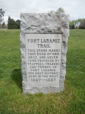
Fort Laramie Trail
1867 - 1887
Topics. This historical marker is listed in these topic lists: Roads & Vehicles • Settlements & Settlers.
Location. 41° 9.727′ N, 104° 49.906′ W. Marker is in Cheyenne, Wyoming, in Laramie County. Marker can be reached from Kennedy Road near Central Avenue, on the right when traveling east. Touch for map. Marker is at or near this postal address: 852 Kennedy Road, Cheyenne WY 82009, United States of America. Touch for directions.
Other nearby markers. At least 8 other markers are within walking distance of this marker. The Trails (Part II) (approx. 0.3 miles away); Floyd and Edna Young Folk Art Fence (approx. 0.3 miles away); Union Pacific Steam Engine #1242 (approx. 0.3 miles away); The Trails (Part I) (approx. 0.3 miles away); Cheyenne Frontier Days™ (Part II) (approx. 0.3 miles away); The Trails (Part III) (approx. 0.3 miles away); Cheyenne Frontier Days™ (Part I) (approx. 0.3 miles away); Early Cheyenne Reservoir (approx. 0.4 miles away). Touch for a list and map of all markers in Cheyenne.
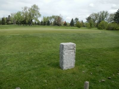
More about this marker. This markers is behind the putting green of the 6th Hole at the Airport Golf Course.
Credits. This page was last revised on June 17, 2016. It was originally submitted on June 17, 2016, by Barry Swackhamer of Brentwood, California. This page has been viewed 347 times since then and 25 times this year. Photos: 1, 2. submitted on June 17, 2016, by Barry Swackhamer of Brentwood, California.

