Leonardtown in St. Mary's County, Maryland — The American Northeast (Mid-Atlantic)
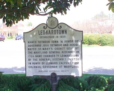
Leonardtown
Established in 1660
Named Seymour Town in honor of Governor John Seymour and designated St. Mary’s county seat by the General Assembly in 1708. Name changed to Leonardtown by the General Assembly in 1728 in honor of Leonard Calvert, first colonial governor of Maryland.
Erected by the Maryland Historical Society.
Topics. This historical marker is listed in these topic lists: Political Subdivisions • Settlements & Settlers. A significant historical year for this entry is 1708.
Location. 38° 17.466′ N, 76° 38.154′ W. Marker is in Leonardtown, Maryland, in St. Mary's County. Marker is at the intersection of Washington Street (Business Maryland Route 5) and Leonardtown Road (Business Maryland Route 5), in the median on Washington Street. Touch for map. Marker is in this post office area: Leonardtown MD 20650, United States of America. Touch for directions.
Other nearby markers. At least 5 other markers are within walking distance of this marker. World War I Monument -- Leonardtown (within shouting distance of this marker); Veterans Memorial (within shouting distance of this marker); The Mural Story (within shouting distance of this marker); Site of the Methodist Episcopal Meeting House (c.1847) (about 500 feet away, measured in a direct line); The Great House (about 500 feet away). Touch for a list and map of all markers in Leonardtown.
Also see . . . Leonardtown. Town website homepage (Submitted on April 18, 2007.)
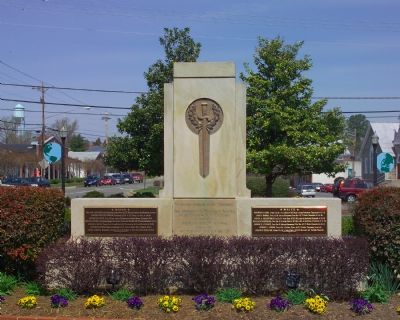
Photographed By Tom Fuchs, March 31, 2007
3. World War I Memorial
This monument is in the center of the Town Square park located in the median of Washington Street. The Inscription reads: “Gloria pro patria in armis contendere. This Monument is Gratefully Erected by the Citizens of St. Mary’s County in honor of Her Heroes in the World War, 1917–1918, and Dedicated this 11th day of November 1921.”
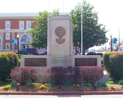
Photographed By Tom Fuchs, March 31, 2007
4. World War I Memorial
This is the back of the memorial. The inscription reads: “Gloria pro patria mori. The Names on This Memorial are of those Who Made the Supreme Sacrifice.” This is the side that faces the marker. Four brass tablets, two on each side, separately list the “white” and “colored” dead. Click on the images to zoom in and read the names.
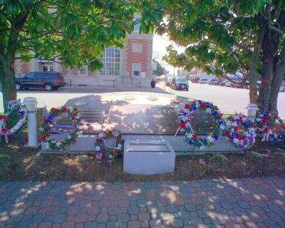
Photographed By Tom Fuchs, March 31, 2007
5. World War II, Korean War, Vietnam War, and Global War on Terrorism Memorial
This monument is on the opposite side of the Town Square Park. The inscription reads: “The citizens of Saint Mary’s County dedicate this monument in memory of those who made the supreme sacrifice and those who valiantly served.” Washington Street, seen in the distance, continues down to the town dock on the Potomac River.
Credits. This page was last revised on March 7, 2022. It was originally submitted on April 18, 2007, by Tom Fuchs of Greenbelt, Maryland. This page has been viewed 1,961 times since then and 19 times this year. Photos: 1, 2, 3, 4, 5, 6. submitted on April 18, 2007, by Tom Fuchs of Greenbelt, Maryland. 7. submitted on April 18, 2007, by J. J. Prats of Powell, Ohio. • J. J. Prats was the editor who published this page.
