Fredericksburg, Virginia — The American South (Mid-Atlantic)
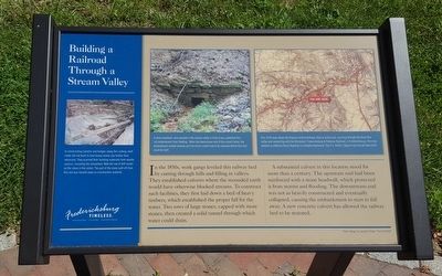
Building a Railroad Through a Stream Valley
Fredericksburg: Timeless.
In the 1850s, work gangs leveled this railway bed by cutting through hills and filling in valleys. They established culverts where the mounded earth would have otherwise blocked streams. To construct such facilities, they first laid down a bed of heavy timbers, which established the proper fall for the water. Two rows of large stones, capped with more stones, then created a solid tunnel through which water could drain.
A substantial culvert in this location stood for more than a century. The upstream end had been reinforced with a stone headwall, which protected it from storms and flooding. The downstream end was not as heavily constructed and eventually collapsed, causing the embankment to start to fall away. A new concrete culvert has allowed the railway bed to be restored.
(captions)
In constructing culverts and bridges along this railway, work crews did not want to haul heavy stones any further than necessary. They quarried their building materials from nearby sources, including the streambed. Note the row of drill marks on the stone in the center. The part of the stone split off from this one was hauled away as construction material.
A stone headwall, once located in the stream valley in front of you, protected this rail embankment from flooding. When the downstream end of the culvert failed, the embankment eroded severely and the entire culvert had to be replaced before this trail could be built.
This 1934 map shows the Virginia Central Railway, then in active use, coursing through the Hazel Run valley and connecting with the Richmond, Fredericksburg & Potomac Railroad, in Fredericksburg. The road labeled as Jefferson Davis Highway is Lafayette Boulevard. The U.S. Route 1 Bypass had not yet been built.
Erected by Fredericksburg Economic Development and Tourism Office.
Topics and series. This historical marker is listed in this topic list: Railroads & Streetcars. In addition, it is included in the Virginia, Fredericksburg: Timeless. series list.
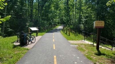
Location. 38° 17.243′ N, 77° 28.987′ W. Marker is in Fredericksburg, Virginia. Marker can be reached from Greenbrier Drive, half a mile south of Blue and Gray Parkway (Virginia Route 3). Located along the Virginia Central Railway Trail near Alum Spring Park. Touch for map. Marker is in this post office area: Fredericksburg VA 22401, United States of America. Touch for directions.
Other nearby markers. At least 8 other markers are within walking distance of this marker. The Virginia Central Railway (about 400 feet away, measured in a direct line); Fredericksburg (approx. 0.2 miles away); Lee’s Position (approx. ¼ mile away); The Battle of Fredericksburg from Lee's Hill, December, 1862 (approx. 0.4 miles away); Lee's Hill, the commander's lookout (approx. 0.4 miles away); Artillery on Lee's Hill (approx. 0.4 miles away); The Pioneers (approx. 0.4 miles away); The Second Battle of Fredericksburg (approx. 0.4 miles away). Touch for a list and map of all markers in Fredericksburg.
Credits. This page was last revised on April 3, 2024. It was originally submitted on June 20, 2016, by Bernard Fisher of Richmond, Virginia. This page has been viewed 348 times since then and 16 times this year. Photos: 1, 2. submitted on June 20, 2016, by Bernard Fisher of Richmond, Virginia.

