Saint Anthony Main in Minneapolis in Hennepin County, Minnesota — The American Midwest (Upper Plains)
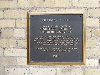
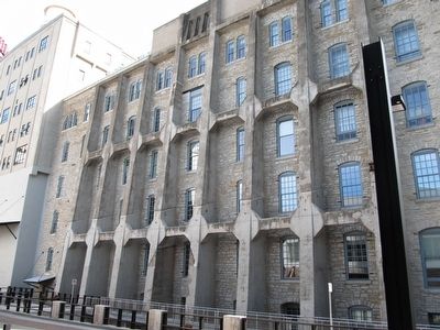
Pillsbury A Mill
Erected 1966 by U.S. Department of the Interior, National Park Service.
Topics and series. This historical marker is listed in this topic list: Industry & Commerce. In addition, it is included in the National Historic Landmarks series list.
Location. 44° 59.01′ N, 93° 15.16′ W. Marker is in Minneapolis, Minnesota, in Hennepin County. It is in Saint Anthony Main. Marker is on Main Street SE, ¼ mile south of Central Avenue SE, on the right when traveling west. Touch for map. Marker is at or near this postal address: 315 Main Street SE, Minneapolis MN 55414, United States of America. Touch for directions.
Other nearby markers. At least 8 other markers are within walking distance of this marker. Follow the Water: Part 2 - Forebay to Tailrace (within shouting distance of this marker); Franklin Steele (within shouting distance of this marker); a different marker also named The Pillsbury A Mill (within shouting distance of this marker); Power on the East Side (about 500 feet away, measured in a direct line); Harnessing Waterpower (about 600 feet away); Electricity and Minneapolis (about 600 feet away); Follow the Water: Part 1 - Intake and Tunnel (about 600 feet away); The Falls That Built the City (about 600 feet away). Touch for a list and map of all markers in Minneapolis.
Regarding Pillsbury A Mill. Pillsbury A Mill has been converted into the A Mill Artists Lofts apartment.
Credits. This page was last revised on February 12, 2023. It was originally submitted on June 23, 2016, by Paul Fehrenbach of Germantown, Wisconsin. This page has been viewed 394 times since then and 15 times this year. Photos: 1, 2, 3, 4, 5. submitted on June 23, 2016, by Paul Fehrenbach of Germantown, Wisconsin. • Bill Pfingsten was the editor who published this page.
