Blacksburg in Montgomery County, Virginia — The American South (Mid-Atlantic)
The Commissary
Photographed by Bernard Fisher, June 26, 2016
1. The Commissary Marker
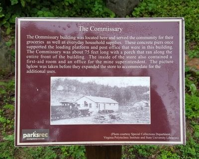
The Commissary building was located here and served the community for their groceries as well as everyday household supplies. These concrete piers once supported the loading platform and post office that were in this building. The Commissary was about 75 feet long with a porch that ran along the entire front of the building. The inside of the store also contained a first-aid room and an office for the mine superintendent. The picture below was taken before they expanded the store to accommodate for the additional uses. (Photo courtesy Special Collections Department, Virginia Polytechnic Institute and State University Libraries)
Erected by Parks & Recreation, Montgomery County, VA.
Topics. This historical marker is listed in this topic list: Industry & Commerce.
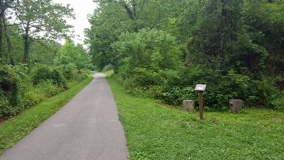
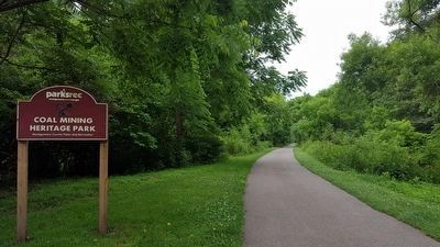
Location. 37° 11.071′ N, 80° 25.979′ W. Marker is in Blacksburg, Virginia, in Montgomery County. It can be reached from the intersection of Merrimac Road and Virginia Route 701, on the left when traveling north. Located on the Huckleberry Trail in the Coal Mining Heritage Park and Loop Trail. Touch for map.
this page online

Regionally, this marker is in Southwest Virginia, in the Blue Ridge Highlands, and in the New River Gorge. It is also in the American South, specifically in the Upper South, in Appalachia, and specifically in Southern Appalachia. Globally, it is in North America, the Western Hemisphere, the Western World, and the Anglosphere. Historically, it finds itself in what was once the territory of the Mississippian Culture, one of the original Thirteen Colonies, one of the Confederate States of America, and the Antebellum South.
Other nearby markers. At least 8 other markers are within 2 miles of this marker, measured as the crow flies: The Hotel (within shouting distance of this marker); Hoist Foundation (approx. 0.2 miles away); The Tipple (approx. 0.2 miles away); Coal Car (approx. 0.2 miles away); Coal Car Hoist (approx. 0.2 miles away); Virginia 4-H State Congress (approx. 1.8 miles away); Virginia Polytechnic Institute and State University (approx. 1.9 miles away); Founding of the Future Farmers of Virginia (approx.
Photographed by Bernard Fisher, June 26, 2016
2. The Huckleberry Trail
Also see . . . Coal Mining Heritage Park and Loop Trail. Montgomery County website entry (Submitted on June 26, 2016.)
Photographed by Bernard Fisher
3. Huckleberry Trail thru Coal Mining Heritage Park
Credits. This page was last revised on July 19, 2024. It was originally submitted on June 26, 2016, by Bernard Fisher of Richmond, Virginia. This page has been viewed 458 times since then and 26 times this year. Photos: 1, 2. submitted on June 26, 2016, by Bernard Fisher of Richmond, Virginia. 3. submitted on June 27, 2016, by Bernard Fisher of Richmond, Virginia.
