Encampment in Carbon County, Wyoming — The American West (Mountains)
Encampment, Wyoming
(Grand Encampment)
| — | Elevation 7,323 feet | — |

Photographed by Jimmy Emerson, October 17, 2026
1. Encampment, Wyoming Marker
Erected by Wyoming State Parks and Cultural Resources.
Topics. This historical marker is listed in these topic lists: Industry & Commerce • Settlements & Settlers.
Location. 41° 12.684′ N, 106° 47.274′ W. Marker is in Encampment, Wyoming, in Carbon County. It is on McCaffrey Avenue (State Highway 70) near 2nd Street, on the left when traveling north. Touch for map. Marker is at or near this postal address: 201 McCaffrey Avenue, Encampment WY 82325, United States of America.
this page online

Regionally, this marker is in the Westward Expansion Trails Region. It is also in the American Mountain West. Globally, it is in North America, the Rocky Mountains, the Western Hemisphere, the Western World, and the Anglosphere. Historically, it finds itself in what was once the Republic of Texas.
Other nearby markers. At least 3 other markers are within 11 miles of this marker, measured as the crow flies: E & H Building (approx. 0.4 miles away); The Willis House (approx. 0.4 miles away); The Sierra Madre Range (approx. 10.8 miles away).

Photographed by Barry Swackhamer, May 29, 2016
2. Encampment, Wyoming Marker
Photographed by Barry Swackhamer, May 29, 2016
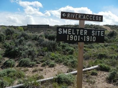
3. Smelter Site (1901-1910)
Located at 2nd Street and Smelter Road.
Photographed by Barry Swackhamer, May 29, 2016
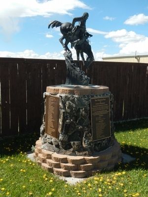
4. The Mountain Man by Frederic Remington
Next to the Encampment marker.

Photographed by Jimmy Emerson, October 17, 2026
5. Encampment, Wyoming Marker
Credits. This page was last revised on October 19, 2026. It was originally submitted on June 27, 2016, by Barry Swackhamer of Brentwood, California. This page has been viewed 884 times since then and 83 times this year. Photos: 1. submitted on October 18, 2026, by Jimmy Emerson of Dalton, Georgia. 2, 3, 4. submitted on June 27, 2016, by Barry Swackhamer of Brentwood, California. 5. submitted on October 18, 2026, by Jimmy Emerson of Dalton, Georgia.
