Near Alcova in Natrona County, Wyoming — The American West (Mountains)
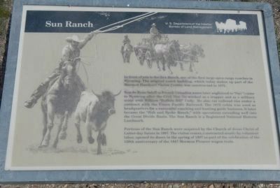
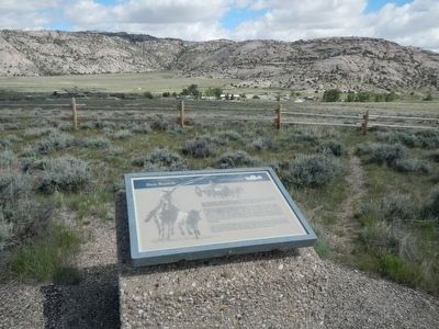
Sun Ranch
Tom de Beau Soleil (a French Canadian name later anglicized to "Sun") came to Wyoming after the Civil War. He worked as a trapper and as a military scout with William "Buffalo Bill" Cody. He also cut railroad ties under contract with the Union Pacific Railroad. The 1872 cabin was used as headquarters for a successful ranching and hunting guide business. It later became the "Hub and Spoke Ranch," with operations extending well into the Great Divide Basin. The Sun Ranch is a Registered National Historic Landmark.
Portions of the Sun Ranch were acquired by the Church of Jesus Christ of Latter-day Saints in 1997. The visitor center, constructed mostly by volunteer labor, opened its doors in the spring of 1997 as part of the celebration of the 150th anniversary of the 1847 Mormon Pioneer wagon train.
Erected by U.S. Department of the Interior, Bureau of Land Management.
Topics. This historical marker is listed in these topic lists: Agriculture • Settlements & Settlers. A significant historical year for this entry is 1872.
Location. 42° 26.284′ N, 107° 13.087′ W. Marker is near Alcova, Wyoming, in Natrona County. Marker is on State Highway 220 near Martin Cove Road, on the right when traveling west. Touch for map. Marker is in this post office area: Alcova WY 82620, United States of America. Touch for directions.
Other nearby markers. At least 8 other markers are within walking distance of this marker. Martin's Cove (within shouting distance of this marker); Devil's Gate (about 300 feet away, measured in a direct line); A Tribute to Hardship (about 300 feet away); Following the River (about 600 feet away); The Emigrant Road (about 700 feet away); Tom Sun Ranch (approx. ¼ mile away); The Oregon Trail (approx. ¼ mile away); The Pioneer Women (approx. ¼ mile away). Touch for a list and map of all markers in Alcova.
More about this marker. This marker is located at the Devil's Gate BLM Interpretive Site, approximately 7 miles southwest of Independence Rock.
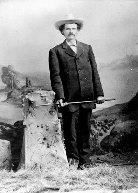
Also see . . . Thomas DeBeau Sun - Find a Grave. Tom Sun with a rifle from his Wild West Show. In 1872, he built a log cabin on Sweetwater Creek near Devil's Gate and the Sun Ranch was born. He made two trips to Oregon and brought back 4,000 head of cattle. He built his ranch into an empire covering more than three million acres and the largest operation in Wyoming. (Submitted on June 29, 2016, by Barry Swackhamer of Brentwood, California.)
Credits. This page was last revised on June 29, 2016. It was originally submitted on June 29, 2016, by Barry Swackhamer of Brentwood, California. This page has been viewed 760 times since then and 47 times this year. Photos: 1, 2, 3. submitted on June 29, 2016, by Barry Swackhamer of Brentwood, California.


