Zanesville in Muskingum County, Ohio — The American Midwest (Great Lakes)
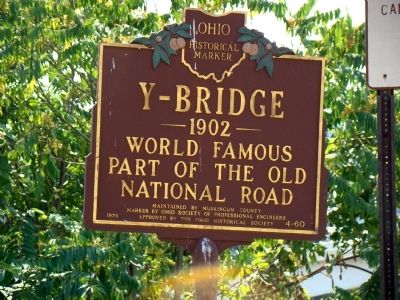
Y-Bridge
— 1902 —
World famous part of the Old National Road.
Maintained by Muskingum County.
Marker by Ohio Society of Professional Engineers.
Approved by the Ohio Historical Society.
Erected 1974 by Ohio Society of Professional Engineers. Approved by the Ohio Historical Society. (Marker Number 4-60.)
Topics and series. This historical marker is listed in these topic lists: Bridges & Viaducts • Roads & Vehicles. In addition, it is included in the Ohio Historical Society / The Ohio History Connection, and the The Historic National Road series lists.
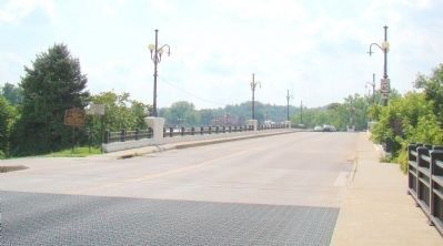
Location. 39° 56.423′ N, 82° 0.765′ W. Marker is in Zanesville, Ohio, in Muskingum County. Marker is on Main Street (U.S. 40), on the right when traveling south. This marker is on the eastern approach to the three-approach bridge. Touch for map. Marker is in this post office area: Zanesville OH 43701, United States of America. Touch for directions.
Other nearby markers. At least 8 other markers are within walking distance of this marker. A different marker also named Y-Bridge (within shouting distance of this marker); a different marker also named Y-Bridge (about 600 feet away, measured in a direct line); The Bicentennial Legacy Monument (approx. 0.2 miles away); Muskingum County Vietnam War Memorial (approx. 0.2 miles away); Muskingum County Iraqi Conflicts Memorial (approx. 0.2 miles away); Muskingum County Medal of Honor Memorial (approx. 0.2 miles away); American Legion Post #29 Veterans Memorial (approx. 0.2 miles away); Three Muskingum County Courthouses (approx. ¼ mile away). Touch for a list and map of all markers in Zanesville.
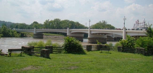
Regarding Y-Bridge. The intersection with Linden Avenue is on the bridge itself. The Bridge spans the confluence of the Licking with the Muskingum river.
Related markers. Click here for a list of markers that are related to this marker. The three Zanesville Y-Bridge markers.
Also see . . . An Article About Zanesville Ohio’s Y-Bridges. This is the fifth Y-bridge built here. “While the [third] bridge was under construction [in 1832] a flood threatened the supports under the eastern span. Ebenezer Buckingham [the owner of the bridge company] hurried the completion of the work. Then he gave orders for the removal of the wedges which held the supports so that the flood waters could carry them away without taking the bridge. When the wedges were removed, the span fell into the river and Buckingham and Jacob Boyd were killed by falling timbers. ” (Submitted on July 26, 2008.)
Photographed By J. J. Prats, July 11, 2008
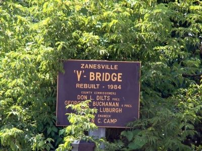
4. Y-Bridge Marker
Tablet reads, “Zanesville ‘Y’–Bridge. Rebuilt – 1984. County Commissioners Don L. Diltz, Pres.; George A. Buchanan, V. Pres.; Ancel G. Luburgh. County Engineer Loren C. Camp.” Three of these tablets are on the bridge. This one, one on the western approach, and one at the intersection on the bridge.
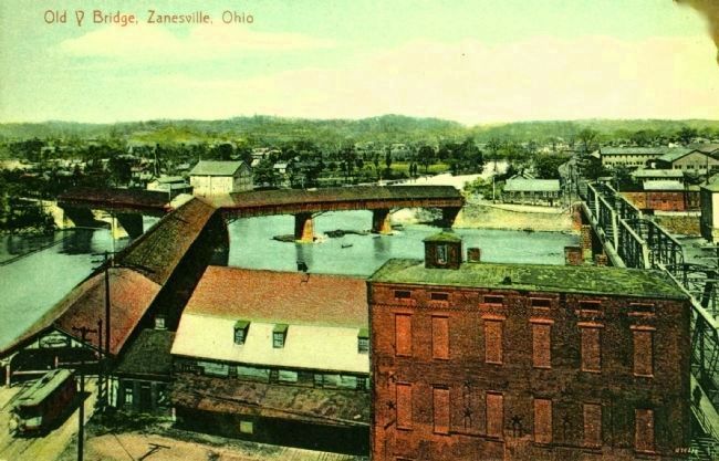
Postcard by Edmiston Book & Sta. Co., circa 1899
7. Old Y Bridge, Zanesville, Ohio
Taken from roughly the same location and looking the same direction as the preceding picture, this postcard view shows the third of the five Y-bridges built in this location. Completed in December, 1832, it was closed in January 1900 by the county because an engineering report had deemed it unsound and not fit for use.

Photographed By J. J. Prats, July 11, 2008
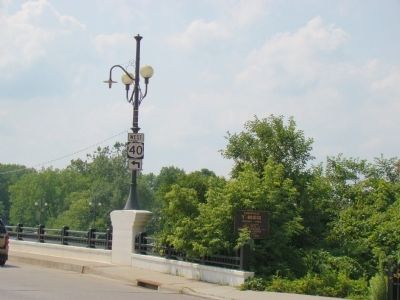
8. Intersection of Main and West Main Streets with Linden Avenue
Linden Avenue goes right, West Main Street goes left and Main Street through downtown Zanesville is behind the photographer. One of the three tablets like the one in Photo 4 is below the US 40 West sign.
Credits. This page was last revised on January 8, 2020. It was originally submitted on July 26, 2008, by J. J. Prats of Powell, Ohio. This page has been viewed 2,517 times since then and 65 times this year. Photos: 1, 2, 3, 4, 5. submitted on July 26, 2008, by J. J. Prats of Powell, Ohio. 6. submitted on March 26, 2010, by J. J. Prats of Powell, Ohio. 7. submitted on January 23, 2015. 8. submitted on July 26, 2008, by J. J. Prats of Powell, Ohio.
