Kemp in Kaufman County, Texas — The American South (West South Central)
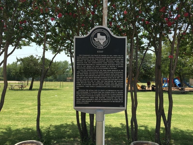
Kemp
It was the construction of the Texas Trunk Railroad in the 1880s, however, that boosted Kemp's growth and development. The Texas Trunk was built to connect Dallas with points east and south and later became part of the Texas and New Orleans Rail Line. As the tracks reached Kaufman (10 mi. N) in 1881, the county surveyor was laying out a town plat for Kemp along the projected rail line. By 1882, one year before the railroad even reached Kemp, the community boasted two dry goods stores, a drugstore, grocery, saloon, saddle shop, barbershop, blacksmith, three church congregations and a steam gin and mill.
Although the actual date of Kemp's incorporation has not been determined, it is known that the citizens voted to abolish their incorporation in 1910 and then elected to reincorporate in 1922. Kemp continued to grow, serving as a trade center for the surrounding farms and ranches. Although the end of World War II signaled a shift in the population to more urban areas, Kemp remains an important community in the history of Kaufman County.
Erected 2002 by Texas Historical Commission. (Marker Number 12818.)
Topics. This historical marker is listed in these topic lists: Industry & Commerce • Railroads & Streetcars • Settlements & Settlers. A significant historical year for this entry is 1851.
Location. 32° 26.522′ N, 96° 13.876′ W. Marker is in Kemp, Texas, in Kaufman County. Marker is on South Main Street south of West 9th Street, on the right when traveling south. Touch for map. Marker is at or near this postal address: 10 S Main St, Kemp TX 75143, United States of America. Touch for directions.
Other nearby markers. At least 8 other markers are within 9 miles of this marker, measured as the crow flies. Lone Oak Cemetery (approx. 3˝ miles away); Pyle Prairie Cemetery (approx. 4.8 miles away); Baker Cemetery (approx. 5 miles away); Fox Cemetery (approx. 7.6 miles away); Capt. Israel Spikes (approx. 7.7 miles away); Capt. Edward Thomas Broughton and the Johnson Guards (approx. 7.9 miles away); Prairieville (approx. 8 miles away); White Hall School (approx. 8.3 miles away). Touch for a list and map of all markers in Kemp.
Credits. This page was last revised on July 18, 2016. It was originally submitted on July 16, 2016, by Rheba Bybee of Seagoville, Texas. This page has been viewed 601 times since then and 50 times this year. Photos: 1, 2, 3. submitted on July 16, 2016, by Rheba Bybee of Seagoville, Texas. • Bernard Fisher was the editor who published this page.


