Hooks in Bowie County, Texas — The American South (West South Central)
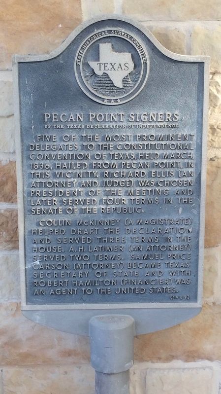
Pecan Point Signers
of the Texas Declaration of Independence
Erected 1969 by State Historical Survey Committee. (Marker Number 12409.)
Topics. This historical marker is listed in these topic lists: Government & Politics • Notable Events. A significant historical month for this entry is March 1836.
Location. 33° 28.542′ N, 94° 17.32′ W. Marker is in Hooks, Texas, in Bowie County. Marker is at the intersection of Main Street (Farm to Market Road 560) and Frontage Interstate 30 Frontage Road, on the right when traveling north on Main Street. Touch for map. Marker is at or near this postal address: Main Street, Hooks TX 75561, United States of America. Touch for directions.
Other nearby markers. At least 8 other markers are within 13 miles of this marker, measured as the crow flies. Hooks (approx. 0.8 miles away); Red Lick Methodist Church (approx. 6˝ miles away); James Bowie / Gold Star County (approx. 6.8 miles away); Bowie County (approx. 6.8 miles away); Red Bayou Methodist Church (approx. 6.9 miles away); New Boston (approx. 7˝ miles away); Jones-Tyson House (approx. 7.8 miles away); Confederate Camp at Richmond / Richmond Church and Cemetery (approx. 12.8 miles away in Arkansas).
More about this marker. As of the date this marker was posted, it was located right up against a pillar of a gas station store. The location is currently under renovation after being shuttered for many years.
Previously it was the Hooks Truck Stop and Texaco Station and now it is the 7Star Travel Plaza.
Credits. This page was last revised on June 16, 2018. It was originally submitted on August 7, 2016, by Mark Hilton of Montgomery, Alabama. This page has been viewed 613 times since then and 36 times this year. Photos: 1, 2, 3. submitted on August 7, 2016, by Mark Hilton of Montgomery, Alabama.


