Corydon in Harrison County, Indiana — The American Midwest (Great Lakes)
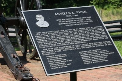
Arville L. Funk
1929-1990
to the memory of Arville L. Funk:
historian, author, lawyer, teacher,
civic and church leader
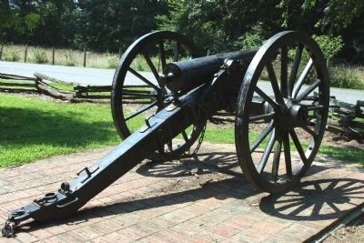
This six-pound field gun is similar to those used by General John Hunt Morganís Raiders and the Harrison County Home Guard. One cannon was used by the Home Guard at Morvinís Landing on the Ohio River. At the Battle of Corydon the Raiders had two cannons directly South of this site under the command of Basil Duke, 6th Kentucky Cavalry Regiment. Two additional cannons were located southwest of this point along the Mauckport Pike. After the Home Guard surrendered, Morgan placed one cannon pointing North and fired over the Town to Notify citizens of the surrender.
The June 1995 placement of this cannon and Historic plaque was made possible through the generous donations of the following firms, individuals, and the general support of the Community.
(Listing of supporters not replicated here for brevity)
Erected 1995.
Topics. This historical marker is listed in this topic list: War, US Civil. A significant historical month for this entry is June 1995.
Location. 38° 11.979′ N, 86° 7.765′ W. Marker is in Corydon, Indiana, in Harrison County. Marker is on Old Indiana 135, on the right when traveling south. South of Corydon on Old 135 just past W. Heidelberg Rd. NW.. The Battle of Corydon Park is on the Left (East) side of the road. Go into the Park. Cannon and marker is on the left. Touch for map. Marker is in this post office area: Corydon IN 47112, United States of America. Touch for directions.
Other nearby markers. At least 8 other markers are within walking distance of this marker. The Site of The Battle of Corydon (here, next to this marker); Morgan's Confederate Dead (a few steps from this marker); Mooring Post and Anchor Chain (a few steps from this marker); Battle of Corydon (within shouting distance of this marker); General John Morgan (within shouting distance of this marker); Site of the Battle of Corydon (about 300 feet away, measured in a direct line); Harrison County (Indiana) Fair (approx. half a mile away); A Fair to Remember (approx. 0.6 miles away). Touch for a list and map of all markers in Corydon.
Credits. This page was last revised on June 16, 2016. It was originally submitted on July 29, 2008, by Al Wolf of Veedersburg, Indiana. This page has been viewed 2,090 times since then and 20 times this year. Photos: 1. submitted on July 30, 2008, by Al Wolf of Veedersburg, Indiana. 2. submitted on July 29, 2008, by Al Wolf of Veedersburg, Indiana. • Craig Swain was the editor who published this page.

