Near Hedgesville in Morgan County, West Virginia — The American South (Appalachia)
Site of the Snyders Evangelical Church
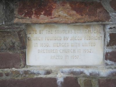
Photographed by J. J. Prats, April 28, 2007
1. Site of the Snyders Evangelical Church Marker
Topics. This historical marker is listed in this topic list: Religion & Religious Structures. A significant historical year for this entry is 1850.
Location. 39° 36.117′ N, 78° 4.176′ W. Marker is near Hedgesville, West Virginia, in Morgan County. It is at the intersection of Martinsburg Road (West Virginia Route 9) and Cherry Run Road, on the left when traveling west on Martinsburg Road. Touch for map. Marker is at or near this postal address: 11348 Martinsburg Rd, Hedgesville WV 25427, United States of America. Touch for directions.

Regionally, this marker is in the Eastern Panhandle. It is also in the American South, specifically in the Upper South, in Appalachia, and specifically in Northern Appalachia. Globally, it is in North America, the Western Hemisphere, the Western World, and the Anglosphere. Historically, it finds itself in what was once the territory of the Mississippian Culture.
Other nearby markers. At least 8 other markers are within 4 miles of this marker, measured
this page online
Another marker is no longer nearby. The National Road (was approx. 3.2 miles away in Maryland but has been permanently removed).
Regarding Site of the Snyders Evangelical Church. This Church merged with Snyder's Bible Chapel, which was an Evangelical United Brethren Church, (further west at the top of the ridge).
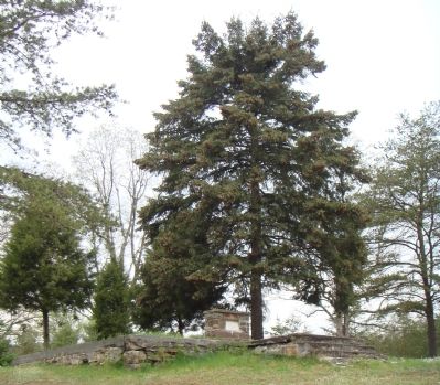
Photographed by J. J. Prats, April 28, 2007
2. Snyder Evangelical Church Foundation and Marker
Credits. This page was last revised on September 23, 2021. It was originally submitted on June 9, 2007, by J. J. Prats of Powell, Ohio. This page has been viewed 2,184 times since then and 58 times this year. Last updated on August 22, 2016, by Charles Fouke of Hedgesville, West Virginia. Photos: 1, 2. submitted on June 9, 2007, by J. J. Prats of Powell, Ohio. • Bill Pfingsten was the editor who published this page.
