Kill Devil Hills in Dare County, North Carolina — The American South (South Atlantic)
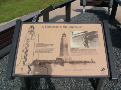
Monument to the Impossible
The Best Design
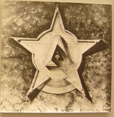
Design competition among 35 entrants was won by Rogers and Poor, a New York Architectural firm.
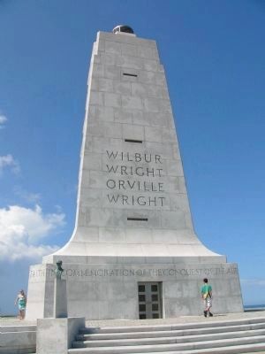
The 60-foot tower, similar to those used to mark courses in air races, embellished with wings on its side and a five-point star serving as the base, was to symbolize man’s conquest of the air.
No Simple Task
Designed with paper and pencil, it became an entirely different matter to carve 80 tons of solid granite. Using hand and pneumatic tools, the Mount Airy granite was transformed into surgically precise multifaceted blocks. Assembled, they formed the Wright Memorial at the final cost of over $285,000.
This memorial to the Wright Brothers serves to inspire people who believe and, by believing, accomplish the impossible.
Erected by National Park Service, U.S. Department of the Interior.
Topics. This historical marker is listed in these topic lists: Air & Space • Architecture.
Location. 36° 0.873′ N, 75° 40.226′ W. Marker is in Kill Devil Hills, North Carolina, in Dare County. Marker is in the Wright Brothers National Memorial, on the driving tour that circles the monument. Touch for map. Marker is in this post office area: Kill Devil Hills NC 27948, United States of America. Touch for directions.
Other nearby markers. At least 8 other markers are within walking distance of this marker. Pitch, Roll and Yaw (here, next to this marker); Big Kill Devil Hill (here, next to this marker); Wright Brothers National Memorial (about 700 feet away, measured in a direct line); a different marker also named Big Kill Devil Hill (approx. 0.2 miles away); Experiments (approx. 0.2 miles away); 12 Seconds that Changed the World (approx. ¼ mile away); A hospitable people... (approx. ¼ mile away); The Conquest of the Air (approx. ¼ mile away). Touch for a list and map of all markers in Kill Devil Hills.

Photographed By Kevin W., July 19, 2008
3. Competition for the Wright Memorial

Photographed By Kevin W., July 19, 2008
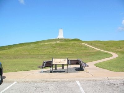
4. The Wright Brothers National Memorial
This wing-shaped monument, completed in 1932, features a beacon rising sixty feet above a ninety-foot sand dune in Kitty Hawk, North Carolina, near where the first flight of a power-driven airplane on December 17, 1903, took place.
Credits. This page was last revised on January 8, 2020. It was originally submitted on July 30, 2008, by Kevin W. of Stafford, Virginia. This page has been viewed 1,428 times since then and 11 times this year. Photos: 1, 2, 3, 4. submitted on July 30, 2008, by Kevin W. of Stafford, Virginia.

