Chalmette in St. Bernard Parish, Louisiana — The American South (West South Central)
The Main Attack
Jean Lafitte National Historical Park and Preserve
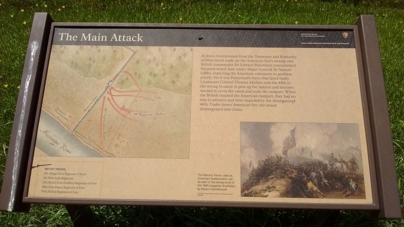
At dawn frontiersmen from Tennessee and Kentucky militias stood ready on the American line's swamp end. British commander Sir Edward Packenham concentrated his main attack here under Major General Sir Samuel Gibbs, expecting the American volunteers to perform poorly. Yet it was Packenham's force that fared badly. Lieutenant Colonel Thomas Mullins sent the 44th to the wrong location to pick up the ladders and fascines needed to cross the canal and scale the rampart. When the British reached the American rampart, they had no way to advance and were impeded by the disorganized 44th. Under heavy American fire, the attack disintegrated into chaos.
(captions)
The Macarty house used as American headquarters, can be seen in the background of this 1845 magazine illustration by Robert Hinshelwood.
British Troops
4th (Kings Own) Regiment of Foot
5th West India Regiment
21st (Royal Scots Fusiliers) Regiment of Foot
95th (Rifles) Regiment of Foot
Erected by National Park Service - United States Department of the Interior.
Topics. This historical marker is listed in this topic list: War of 1812. A significant historical year for this entry is 1815.
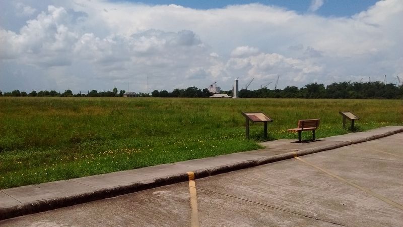
Location. 29° 56.659′ N, 89° 59.365′ W. Marker is in Chalmette , Louisiana, in St. Bernard Parish. Marker is on Chalmette National Park Scenic Road (Tour Loop Rd), 0.2 miles east of Battlefield Road, on the left when traveling west. The Chalmette National Park Scenic Road, or Tour Loop Road, is located within the Chalmette Battlefield portion of the Jean Lafitte National Historical Park and Preserve. Touch for map. Marker is in this post office area: Chalmette LA 70043, United States of America. Touch for directions.
Other nearby markers. At least 8 other markers are within walking distance of this marker. Pakenham's Fall (here, next to this marker); Roads and Ditches (approx. 0.2 miles away); Here We Honor Veterans Who Served Their Country (approx. 0.2 miles away); Chalmette National Cemetery (approx. 0.2 miles away); Serving Those Who Saved Us (approx. 0.2 miles away); a different marker also named Chalmette National Cemetery (approx. 0.2 miles away); Batteries Seven and Eight (approx. 0.2 miles away); Batteries Five and Six (approx. 0.2 miles away). Touch for a list and map of all markers in Chalmette.
Also see . . . Chalmette Battlefield. NPS Jean Lafitte National Historical Park and Preserve website entry (Submitted on August 23, 2016, by Tom Bosse of Jefferson City, Tennessee.)
Credits. This page was last revised on January 12, 2022. It was originally submitted on August 23, 2016, by Tom Bosse of Jefferson City, Tennessee. This page has been viewed 377 times since then and 19 times this year. Photos: 1, 2. submitted on August 23, 2016, by Tom Bosse of Jefferson City, Tennessee. • Bernard Fisher was the editor who published this page.

