National Wildlife System
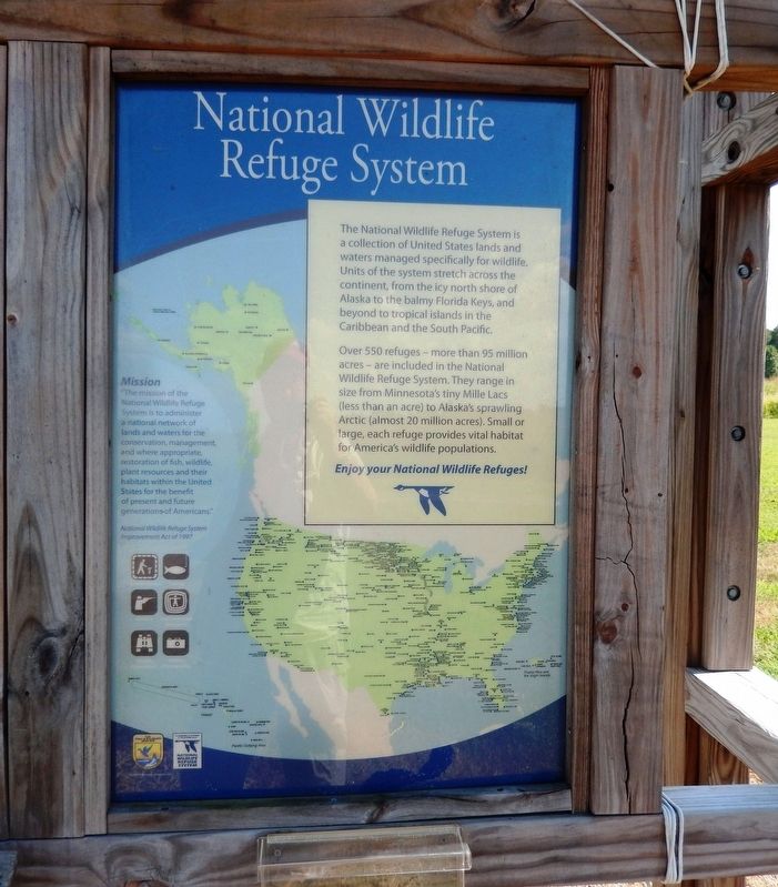
Over 550 refuges—more than 95 million acres—are included in the National Wildlife Refuge System. They range in size from Minnesota’s tiny Mille Lacs (less than an acre) to Alaska’s sprawling Arctic (almost 20 million acres). Small or large, each refuge provides vital habitat for America’s wildlife populations. Enjoy your National Wildlife Refuges!
Mission
“The mission of the National Wildlife Refuge System is to administer a natonal network of lands and waters for the conservation, management, and where appropriate, restoration of fish, wildlife, plant resources and their habitats within the United States for the benefit of present and future generations of Americans.” National Wildlife Refuge System Improvement Act of 1997.
Erected by U.S. Fish & Wildlife Service and National Wildlife Refuge
this page online
Topics. This historical marker is listed in these topic lists: Animals • Environment.
Location. 37° 56.711′ N, 76° 52.824′ W. Marker is in Tappahannock, Virginia, in Essex County. It is on Tidewater Trail. This marker is near the entrance. Touch for map. Marker is at or near this postal address: 19180 Tidewater Trail, Tappahannock VA 22560, United States of America. Touch for directions.

Regionally, this marker is on Virginia’s Middle Peninsula. It is also in the American South, specifically in the Upper South, in the Tidewater, in the Chesapeake Bay Region, and on the Eastern Seaboard. Globally, it is in the North Atlantic Region, North America, the Western Hemisphere, the Western World, and the Anglosphere. Historically, it finds itself in what was once the territory of the Mississippian Culture, one of the original Thirteen Colonies, one of the Confederate States of America, and the Antebellum South.
Other nearby markers. At least 8 other markers are within 2 miles of this marker, measured as the crow flies: Pollinators (a few steps from this
Credits. This page was last revised on September 7, 2016. It was originally submitted on August 24, 2016, by Don Morfe of Baltimore, Maryland. This page has been viewed 372 times since then and 17 times this year. Photos: 1, 2, 3. submitted on August 24, 2016, by Don Morfe of Baltimore, Maryland. • Bill Pfingsten was the editor who published this page.
