Worland in Washakie County, Wyoming — The American West (Mountains)
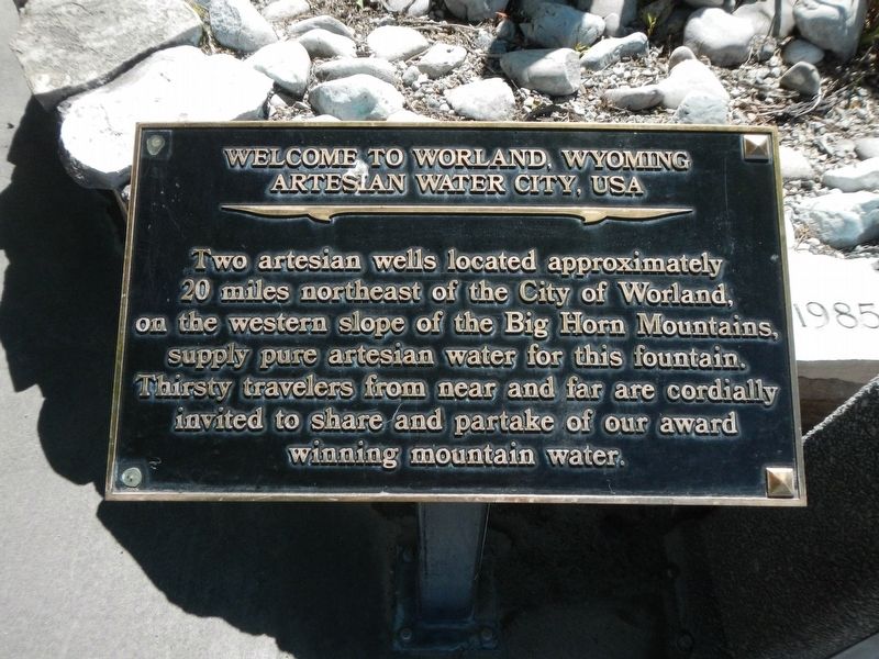
Welcome to Worland, Wyoming
Artesian Water City, USA
Photographed by Barry Swackhamer, June 4, 2016
1. Welcome to Worland, Wyoming Marker
Erected by City of Worland.
Topics. This historical marker is listed in this topic list: Natural Resources.
Location. 44° 1.062′ N, 107° 57.337′ W. Marker is in Worland, Wyoming, in Washakie County. It is at the intersection of North 10th Street (U.S. 20) and Robertson Avenue, on the right when traveling north on North 10th Street. Touch for map. Marker is at or near this postal address: 198 North 10th Street, Worland WY 82401, United States of America. Touch for directions.

Regionally, this marker is in Wyoming’s Bighorn Basin. It is also in the American Mountain West. Globally, it is in North America, the Rocky Mountains, the Western Hemisphere, the Western World, and the Anglosphere.
Other nearby markers. At least 7 other markers are within 5 miles of this
this page online
Photographed by Barry Swackhamer, June 4, 2016
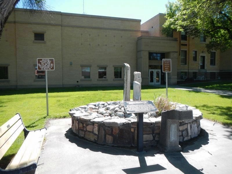
2. Welcome to Worland, Wyoming Marker
Two addition plaques behind the fountain read:
Mountain Artesian Well
Depth 4330'
Gal. per Day 20 mil.
Pressure 200 psi
Temperature 76 degrees
20 miles N.E.
and
We're proud of out mountain artesian water, try it!
Gal. per Day 20 mil.
Pressure 200 psi
Temperature 76 degrees
20 miles N.E.
and
We're proud of out mountain artesian water, try it!
Credits. This page was last revised on September 15, 2016. It was originally submitted on September 15, 2016, by Barry Swackhamer of Brentwood, California. This page has been viewed 1,150 times since then and 126 times this year. Photos: 1, 2. submitted on September 15, 2016, by Barry Swackhamer of Brentwood, California.
