Near Aladdin in Crook County, Wyoming — The American West (Mountains)
Tipple Operation
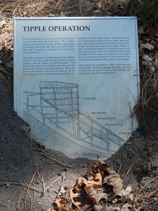
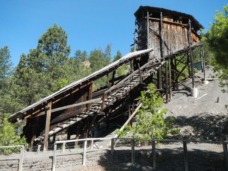
The tipple consists of two distinct parts: the coal bin, which is the large gable-roofed structure (uphill portion) and the chutes (downhill portion). The gable-roofed structure would receive and store the coal for the sorting and loading process. When the door at the bottom of the bin was opened, the tapered, funnel shape of the bin floor would gravity feed the coal to the chute system. The chute system was constructed in such a way as to allow nut-sized, egg, and lump-sized coal to be sorted as it traveled by gravity down the slope of the tipple. Their are three transloading chutes for dumping sorted coal into the train cars. Prior to sediment eroding from the hillside above, their was sufficient room under the two lower bays for train cars. The third track was loaded from the chute on the south face of the tipple.
The remains of a catwalk are visible on the east side of the tipple. From the catwalk the tipple operator would coax the coal down the chute, pulling and poking the coal with a handled tool.
Click on the marker image to see a cross-sectional view of the tipple
Erected by Aladdin Historical Society.
Topics. This historical marker is listed in this topic list: Industry & Commerce.
Location. 44° 38.334′ N, 104° 9.762′ W. Marker is near Aladdin, Wyoming, in Crook County. Marker can be reached from Wyoming Route 24 near Owl Creek Road, on the left when traveling east. Touch for map. Marker is in this post office area: Aladdin WY 82710, United States of America. Touch for directions.
Other nearby markers. At least 8 other markers are within 8 miles of this marker, measured as the crow flies. Tipple Stabilazation (sic) (here, next to this marker); Coal Production (here, next to this marker); Aladdin Tipple History (a few steps from this marker); Later Years of Operation (within shouting distance of this marker); Adit Entrance (within shouting distance of this marker); The Hoist House (within shouting distance of this marker); Bioremediation (within shouting distance of this marker); Vore Buffalo Jump (approx. 7.1 miles away). Touch for a list and map of all markers in Aladdin.
More about this marker. Aladdin Tipple Historical Interpretive Park is approximately 1/2 mile east of Aladdin.
Credits. This page was last revised on July 18, 2020. It was originally submitted on September 22, 2016, by Barry Swackhamer of Brentwood, California. This page has been viewed 700 times since then and 83 times this year. Photos: 1, 2, 3. submitted on September 22, 2016, by Barry Swackhamer of Brentwood, California.


