
Near Honeybee in Whitley County, Kentucky — The American South (East South Central)
CCC at Cumberland Falls
⎯⎯⎯
Civilian Conservation Corps
Photographed by Christopher Light, June 21, 2008
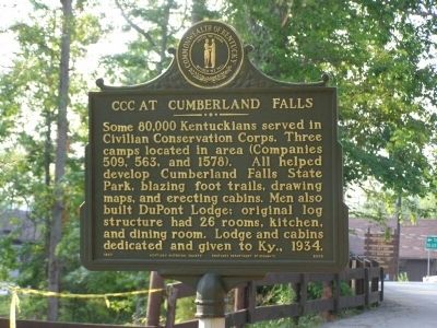
1. CCC at Cumberland Falls Marker, side one
(side one) Some 80,000 Kentuckians served in Civilian Conservation Corps. Three camps located in area (Companies 509, 563, and 1578). All helped develop Cumberland Falls State Park, blazing foot trails, drawing maps, and erecting cabins. Men also built DuPont Lodge; original log structure had 26 rooms, kitchen, and dining room. Lodge and cabins dedicated and given to Ky., 1934.
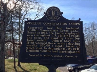
(side two) Roosevelt's New Deal included Civilian Conservation Corps (CCC). Begun in 1933, the Corps employed men throughout U.S. building roads and dams, and planting trees for flood control. Jobless boys ages 18-25 received three meals a day and usually $30.00 a month (most of which went to dependents). By 1941, 2 million youths had participated.
Erected 1997 by Kentucky Historical Society & Kentucky Department of Highways. (Marker Number 2002.)
Topics and series. This historical marker is listed in these topic lists: Charity & Public Work • Notable Events. In addition, it is included in the Civilian Conservation Corps (CCC), and the Kentucky Historical Society series lists. A significant historical year for this entry is 1934.
Location. 36° 50.405′ N,
this page online

Regionally, this marker is in Eastern Kentucky and in the Cumberland Plateau. It is also in the American South, specifically in the Upper South, in Appalachia, and specifically in Southern Appalachia. Globally, it is in North America, the Western Hemisphere, the Western World, and the Anglosphere. Historically, it finds itself in what was once the territory of the Mississippian Culture and also the Antebellum South.
Other nearby markers. At least 8 other markers are within 12 miles of this marker, measured as the crow flies: Kiwanis Trail (a few steps from this marker); Cumberland Falls… (approx. ¼ mile away); Cumberland Falls MoonBow (approx. ¼ mile away); Niagara of the South (approx. 0.4 miles away); Big Bend Loop (approx. 0.4 miles away); McCreary County, 1912
Photographed by Michael Frazier, November 21, 2013
2. ivilian Conservation Corps Marker, side two
Another marker is no longer nearby. 4-H Craft Center (was approx. 3.1 miles away but has been confirmed missing).
Photographed by Christopher Light, June 21, 2008
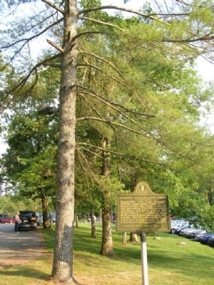
3. Civilian Cnoservation Corps Marker
Photographed by Michael Frazier, November 21, 2013
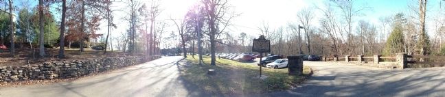
4. CCC at Cumberland Falls Marker
Panoramic view of the CCC-constructed DuPont Lodge at Cumberland Falls Resort State Park
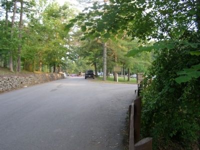
Photographed by Christopher Light, June 21, 2008
5. Entrance to Cumberland Falls State Resort Park Lodge
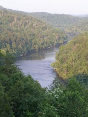
Photographed by Christopher Light, June 21, 2008
6. Cumberland River


Photographed by Tom Bosse, July 12, 2025
8. DuPont Lodge at Cumberland Falls State Resort Park

Photographed by Tom Bosse, July 12, 2025
9. Cumberland Falls

Photographed by Tom Bosse, July 12, 2025
10. Cumberland Falls
Credits. This page was last revised on July 31, 2025. It was originally submitted on August 2, 2008, by Christopher Light of Valparaiso, Indiana. This page has been viewed 4,335 times since then and 59 times this year. Photos: 1. submitted on August 2, 2008, by Christopher Light of Valparaiso, Indiana. 2. submitted on December 20, 2013, by Michael Frazier of Fort Myers, Florida. 3. submitted on August 2, 2008, by Christopher Light of Valparaiso, Indiana. 4. submitted on December 20, 2013, by Michael Frazier of Fort Myers, Florida. 5, 6. submitted on August 2, 2008, by Christopher Light of Valparaiso, Indiana. 7. submitted on January 26, 2022, by Larry Gertner of New York, New York. 8, 9, 10. submitted on July 29, 2025, by Tom Bosse of Jefferson City, Tennessee. • Craig Swain was the editor who published this page.
