San Miguel de Allende, Guanajuato, Mexico — The Central Highlands (North America)
Izquinapan and the Founding of San Miguel de Allende
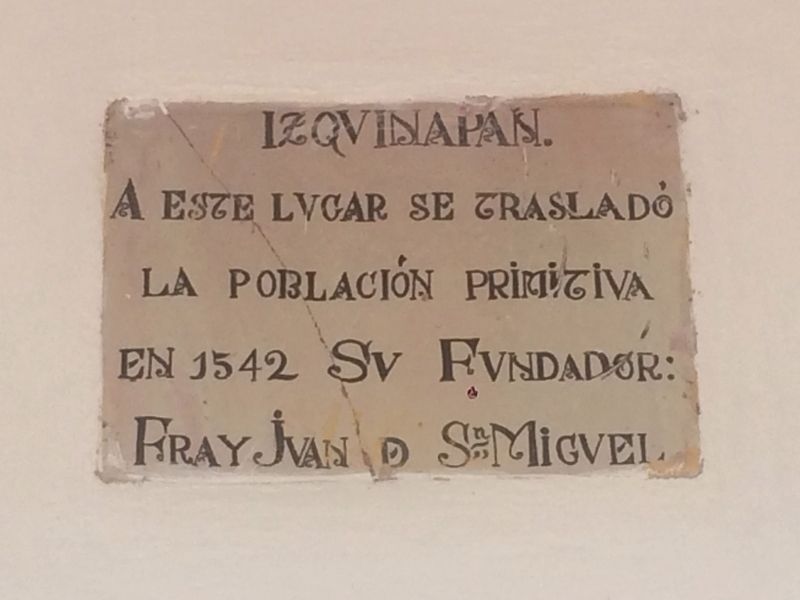
Inscription.
Izquinapan
A este lugar se trasladó
la población primitiva
en 1542 Su Fundador:
Fray Juan de Sn Miguel
English translation:
Izquinapan
The first primitive population was founded here in 1542
by Friar Juan de San Miguel
Topics. This historical marker is listed in these topic lists: Colonial Era • Settlements & Settlers. A significant historical year for this entry is 1542.
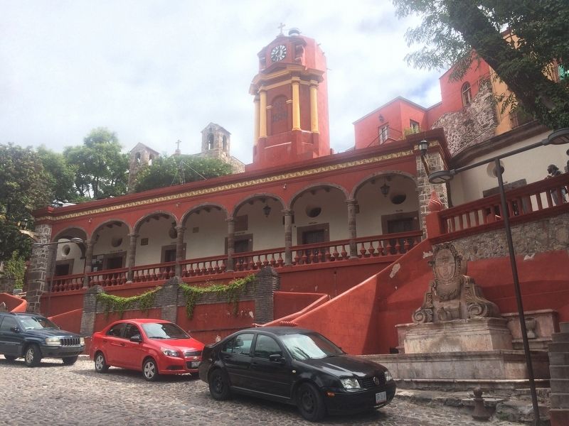
Location. 20° 54.537′ N, 100° 44.436′ W. Marker is in San Miguel de Allende, Guanajuato. Marker can be reached from Calle El Chorro. The marker is mounted to the front of the Casa de Cultura (Cultural Center) of San Miguel de Allende. Touch for map. Marker is in this post office area: San Miguel de Allende GTO 37700, Mexico. Touch for directions.
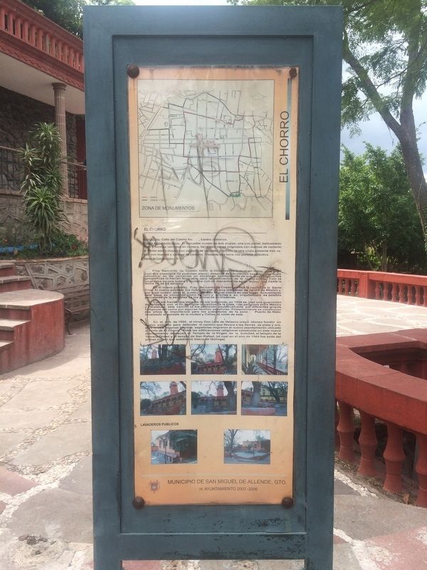
Other nearby markers. At least 8 other markers are within walking distance of this marker. El Chorro Neighborhood (here, next to this marker); The Fountain (El Chorro) (a few steps from this marker); Benito Juárez Park (about 120 meters away, measured in a direct line); José Mojica (about 210 meters away); Pedro Vargas (about 210 meters away); Tomás Delgado Diosdado (approx. 0.3 kilometers away); Juan José Martínez (approx. 0.4 kilometers away); Luis Pérez Lara (approx. 0.4 kilometers away). Touch for a list and map of all markers in San Miguel de Allende.
Additional commentary.
1. Additional CONACULTA markers at the Casa de Cultura
There are two additional markers from the Consejo Nacional para la Cultura (National Council for Culture, CONACULTA) at the location, one from both 2002 and 2011. These markers describe that the facilities were rehabilitated.
— Submitted October 16, 2016, by J. Makali Bruton of Accra, Ghana.
Photographed By J. Makali Bruton, October 8, 2016
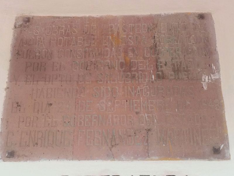
2. An additional marker for a 1943 water system for San Miguel de Allende
It reads:
Las obras de abastecimiento de agua potable en esta población fueron construidas en cooperación por el gobierno del estado y el dpto. de salubridad publica habiendo sido inaguradas (sic) el dia 24 de septiembre de 1943 por el gobernador del estado, C. Enrique Fernandez Martinez.
Photographed By J. Makali Bruton, October 8, 2016
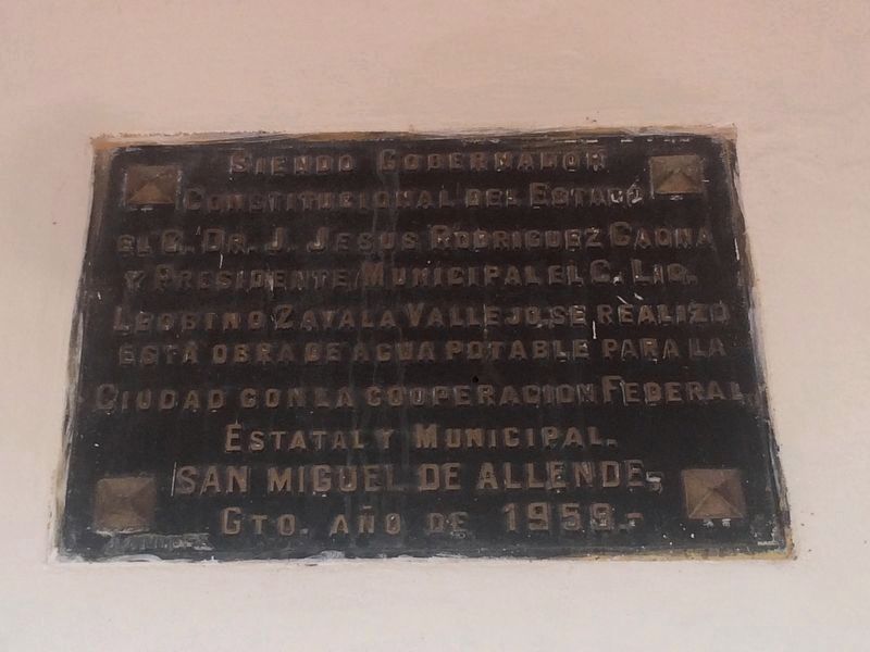
3. An additional marker for a 1959 water system for San Miguel de Allende
This additional marker is also along the Casa de Cultura. It reads:
Siendo Gobernador Constitutional del Estado el G. Cr. J. Jesus Rodriguez Gaona y Presidente Municipal el C. Lic. Leogino Zavala Vallejo, se realizo esta obra de agua potable para la Ciudad con la cooperación Federal, Estatal y Municipal. San Miguel de Allende, Gto. Año de 1959.-
Photographed By J. Makali Bruton, October 8, 2016
5. Izquinapan and the Founding of San Miguel de Allende Marker
The marker can be seen between the fourth and fifth column from the left in front of the Casa de Cultura. To the right is a fountain which supposedly marks the location of the original spring here, which was the reason for founding the town in this location.
Credits. This page was last revised on May 29, 2021. It was originally submitted on October 16, 2016, by J. Makali Bruton of Accra, Ghana. This page has been viewed 263 times since then and 18 times this year. Photos: 1, 2, 3, 4, 5. submitted on October 16, 2016, by J. Makali Bruton of Accra, Ghana.
