Near Oakland in Douglas County, Oregon — The American West (Northwest)
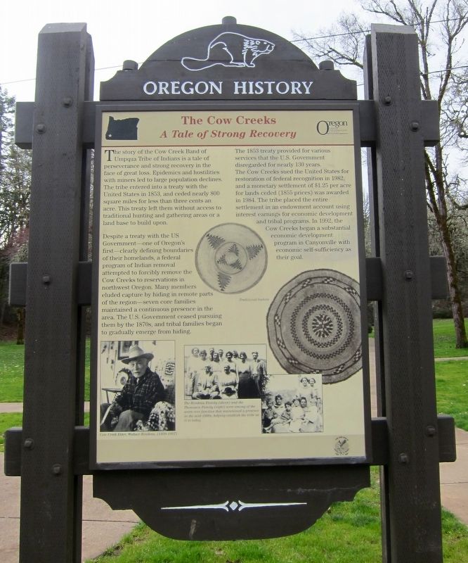
The Cow Creeks
A Tale of Strong Recovery
Despite a treaty with the U.S. Government – one of Oregon’s first – clearly defining boundaries of their homelands, a federal program of Indian removal attempted to forcibly remove the Cow Creeks to reservations in northwest Oregon. Many members eluded capture by hiding in remote parts of the region – seven core families maintained a continuous presence in the area. The U.S. Government ceased pursuing them by the 1870s, and tribal families began to gradually emerge from hiding.
The 1853 treaty provided for various services that the U.S. Government disregarded for nearly 130 years. The Cow Creeks sued the United States for restoration of federal recognition in 1982, and a monetary settlement of $1.25 per acre for lands ceded (1855 prices) was awarded in 1984. The tribe placed the entire settlement in an endowment account using interest earnings for economic development and tribal programs. In 1992, the Cow Creeks began a substantial economic development program in Canyonville with economic self-sufficiency as their goal.
Erected by Oregon Travel Information Council.
Topics and series. This historical marker is listed in this topic list: Native Americans. In addition, it is included in the Oregon Beaver Boards series list.
Location. 43° 28.596′ N, 123° 19.253′ W. Marker is near Oakland, Oregon, in Douglas County. Marker is on Interstate 5, on the right when traveling south. Touch for map. Marker is in this post office area: Oakland OR 97462, United States of America. Touch for directions.
Other nearby markers. At least 5 other markers are within 17 miles of this marker, measured as the crow flies. The First Cabin in Douglas County (approx. 2.9 miles away); Historic Oakland (approx. 3.9 miles away); Applegate Trail - Oakland (approx. 4 miles away); Water Wheel (approx. 4 miles away); Pinot Noir (approx. 16.8 miles away).
More about this marker. The marker is located in the Cabin Creek Rest Area South on Interstate 5. In other words, it is only reachable when traveling south on I-5.
Also see . . .
1. The Cow Creek Band of Umpqua Indians (U.S.History.com). (Submitted on October 29, 2016.)
2. Oregon Travel Experience - The Cow Creeks. (Submitted on January 12, 2018, by Douglass Halvorsen of Klamath Falls, Oregon.)
Credits. This page was last revised on October 14, 2020. It was originally submitted on October 29, 2016, by Andrew Ruppenstein of Lamorinda, California. This page has been viewed 386 times since then and 24 times this year. Photos: 1, 2. submitted on October 29, 2016, by Andrew Ruppenstein of Lamorinda, California.

