Stillwater in Saratoga County, New York — The American Northeast (Mid-Atlantic)
North Redan
Photographed by Bill Coughlin, July 16, 2013
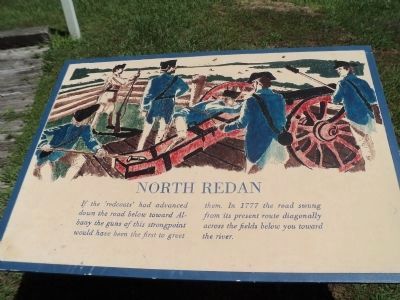
1. North Redan Marker
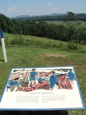
If the ‘redcoats’ had advanced down the road below toward Albany the guns of this strongpoint would have been the first to greet them. In 1777 the road swung from its present route diagonally across the fields below you toward the river.
Erected by Saratoga National Historical Park, National Park Service.
Topics. This historical marker is listed in these topic lists: Military • Notable Places • War, US Revolutionary. A significant historical year for this entry is 1777.
Location. Marker has been permanently removed. It was located near 42° 58.958′ N, 73° 37.525′ W. Marker was in Stillwater, New York, in Saratoga County. It was on Park Tour Road, on the left when traveling south. Marker is in Saratoga National Historical Park along the auto tour road. Touch for map. Marker was in this post office area: Stillwater NY 12170, United States of America.
We have been informed that this marker is no longer there and will not be replaced. This page is an archival view of what was.
Regionally, this marker was in Upstate New York, in the Capital District, and in the Albany Metropolitan Area. It was also in the American

this page online
Other nearby markers. At least 8 other markers are within walking distance of this location: A Liberty Loving Engineer (within shouting distance of this marker); “You will observe that we have some new works.” (about 400 feet away, measured in a direct line); “The General … Discovered a Spot which Fully Answered His Wishes” (about 700 feet away); High Ground Halts an Invasion (about 700 feet away); Nicholas Fish (about 800 feet away); “We have a Fine Train of Artillery, consisting of 24 Pieces” (approx. 0.2 miles away); The Enemy of My Enemy is My Friend (approx. ¼ mile away); Not Everyone’s Loyalties are Clear (approx. ¼ mile away). Touch for a list and map of all markers in Stillwater.
Other markers no longer nearby. Questions of Loyalty (was about 600 feet away but has been permanently removed); Fortifying The High Ground (was about 600 feet away but
Photographed by Bill Coughlin, July 16, 2013
2. North Redan Marker
More about this marker. The top of the marker contains an engraving of an American artillery crew manning a cannon that overlooks the road to Albany.
Also see . . .
1. The Battle of Saratoga. Saratoga County Chamber of Commerce website entry (Submitted on March 29, 2022, by Larry Gertner of New York, New York.)
2. Saratoga National Historical Park. National Park Service. (Submitted on August 4, 2008, by Bill Coughlin of Woodland Park, New Jersey.)
3. A British perspective on the Battle of Saratoga from BritishBattles.com. (Submitted on July 18, 2013, by Bill Coughlin of Woodland Park, New Jersey.)
Photographed by Bill Coughlin, July 13, 2008
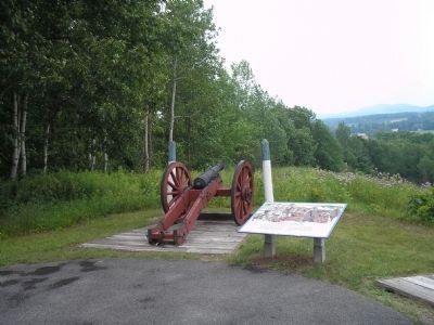
3. Marker in Saratoga National Historical Park
Col. Thaddeus Kosciuszko, a Polish military engineer and volunteer in the patriot cause, set up these fortifications at this strategic location overlooking the road to Albany.
Photographed by Bill Coughlin, July 13, 2008
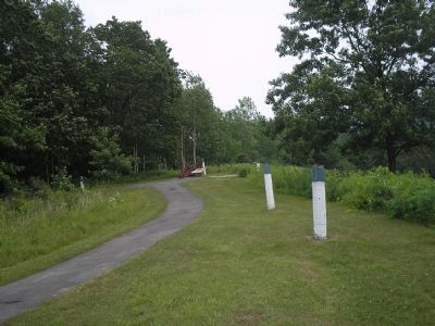
4. American River Fortifications
These fortifications, together with batteries on the banks of the Hudson River, prevented the British from using the road below. This forced Burgoyne to attack the main American line on Bemis Heights on September 19, 1777.
Photographed by Bill Coughlin, July 13, 2008
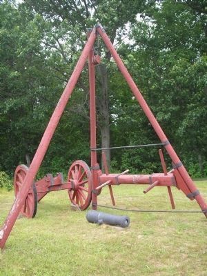
5. Revolutionary War Cannon
This tripod was used by Continental soldiers to load cannons onto their carriages. It is located a short distance from the marker.
Credits. This page was last revised on August 2, 2024. It was originally submitted on August 4, 2008, by Bill Coughlin of Woodland Park, New Jersey. This page has been viewed 1,190 times since then and 21 times this year. Photos: 1, 2. submitted on July 18, 2013, by Bill Coughlin of Woodland Park, New Jersey. 3, 4, 5. submitted on August 4, 2008, by Bill Coughlin of Woodland Park, New Jersey.
