Southwest Quadrant in Alexandria, Virginia — The American South (Mid-Atlantic)
Hooff's Run Bridge
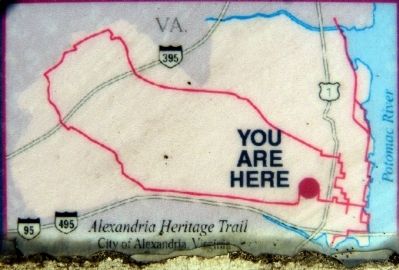
Alexandria Heritage Trail
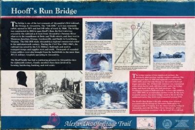
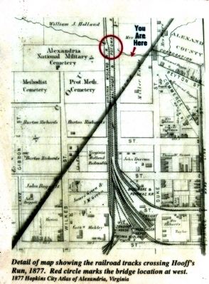
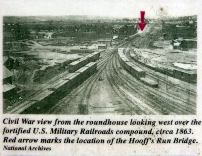
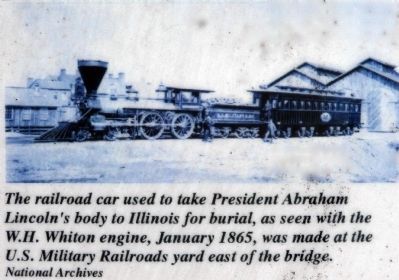
The bridge is one of the last remnants of Alexandria's first railroad, the Orange & Alexandria. The “O&ARR,” as it was commonly called, opened in 1851 and had 148 miles of track in 1860. The bridge was constructed by the railroad as it went from Alexandria's Potomac River wharves to the roundhouse at Duke and Wolfe streets, and then west to Manassas Junction, Orange, Gordonsville, and finally to Lynchburg, Virginia. The O&ARR made Alexandria a regional commercial center in the mid-nineteenth century. During the Civil War (1861-1865), the railroad was seized by the U.S. Military Railroads and used to transport troops and supplies west and south. Thousands of wounded Union soldiers were also brought from the battlefields to the more than 30 U.S. military hospitals operating in Alexandria.
The Hooff family has had a continuing presence in Alexandria since the eighteenth century. Family members have been involved in farming, butchering, banking, and real estate.
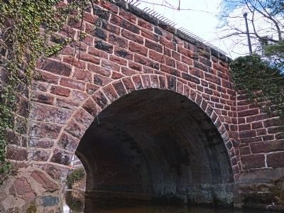
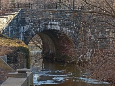
The bridge consists of two round arch sections: the northern, older portion, and the southern addition. The northern part dates from 1856 and replaced a wooden trestle (1851-1895) used when the Orange & Alexandria Railroad began operation. The 28-foot wide structure was constructed with a brick barrel vault, still observable under the bridge today, and faced with gray dry-laid sandstone. The Washington-Southern Railroad built a 16-foot wide addition, circa 1885-1895, to accommodate another track. By the early twentieth century, two more bridges stood to the north with additional tracks; they both were dismantled around 1948.
The Hooff's Run Bridge is the only existing stone structure associated with the Orange & Alexandria Railroad in the Commonwealth of Virginia. It is the oldest surviving bridge in Alexandria, and te Wilkes Street Tunnel, one of two preserved structures associated with the town's first railroad.
Erected by The Marriott Corporation & The Alexandria Archaeology Museum.
Topics and series. This historical marker is listed in these topic lists: Bridges & Viaducts • Railroads & Streetcars • War, US Civil. In addition, it is included in the Orange and Alexandria Railroad, and the Virginia, The City of Alexandria series lists. A significant historical year for this entry is 1851.
Location. 38° 48.18′ N, 77° 3.493′ W. Marker is in Alexandria, Virginia. It is in the Southwest Quadrant. Marker is at the intersection of Jamieson Avenue and Daingerfield Road, on the right when traveling west on Jamieson Avenue. The continuation of Daingerfield Road here is a foot path between The Marriott Residence

Photographed By Allen C. Browne, March 8, 2014
2. Lawrence Hooff, II
The first Lawrence Hooff moved here to sell Conestoga wagons to General Braddock for the French and Indian War; son Lawrence (above) was pallbearer at George Washington's funeral. Close-up of silhouette on marker
Alexandria Library, Special Collections
Alexandria Library, Special Collections
Other nearby markers. At least 8 other markers are within walking distance of this marker. The West End (a few steps from this marker); The Duke Street Tanyard (about 300 feet away, measured in a direct line); African American Heritage Memorial (about 400 feet away); A National Cemetery System (about 500 feet away); "Pursuers of Booth the Assassin" (about 500 feet away); In Honor of Those Who Gave the Ultimate Sacrifice (about 500 feet away); Alexandria National Cemetery (about 500 feet away); The Edmonson Sisters (about 700 feet away). Touch for a list and map of all markers in Alexandria.
Also see . . .
1. Hooff’s Run was conduit for commerce, disease. By Pamela Cressey, September 7, 1995, Historic Alexandria. (Submitted on March 11, 2014, by Allen C. Browne of Silver Spring, Maryland.)
2. Alexandria Heritage Trail. Alexandria Archaeology Museum (Submitted on March 17, 2014.)
Photographed By Allen C. Browne, March 8, 2014
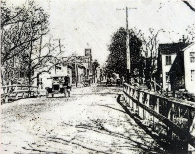
3. Duke Street, 1923
Cars travelling on Duke Street once had to cross over Hooff's Run on a stone bridge. In this 1923 view, the Hooff's Run Bridge is farther downstream to the right; Old Town is in the background. Close-up of photo on marker
Alexandria Library, Special Collections
Alexandria Library, Special Collections

Photographed By Allen C. Browne, March 8, 2014
4. Brick Barrel Vaults
The brick barrel vaults of both the original stone bridge and the southern addition are laid in all-stretcher bond; the semicircular arch spans 21 feet 1 1/2 inches and rises 10 feet 6 inches. Close-up of photo on marker
Alexandria Archaeology Museum
Alexandria Archaeology Museum
Photographed By Allen C. Browne, March 8, 2014
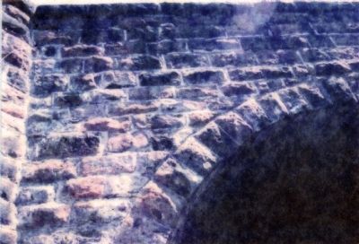
6. The Southern Addition
The southern addition to Hooff's Run Bridge constructed of red Seneca Sandstone has an arch composed of 33 rock-face ashlar voussoirs and a larger keystone. The east wing wall descends on top of the Alexandria National Cemetery wall, which is made of similar stone.Close-up of photo on marker
Alexandria Archaeology Museum
Alexandria Archaeology Museum
Credits. This page was last revised on January 27, 2023. It was originally submitted on March 11, 2014, by Allen C. Browne of Silver Spring, Maryland. This page has been viewed 1,904 times since then and 87 times this year. Last updated on November 3, 2016, by Allen C. Browne of Silver Spring, Maryland. Photos: 1, 2, 3, 4, 5, 6, 7, 8, 9, 10, 11, 12, 13, 14. submitted on March 11, 2014, by Allen C. Browne of Silver Spring, Maryland. • Bill Pfingsten was the editor who published this page.
