Socastee in Horry County, South Carolina — The American South (South Atlantic)
Socastee Methodist Church
Photographed by J. J. Prats, February 8, 2007
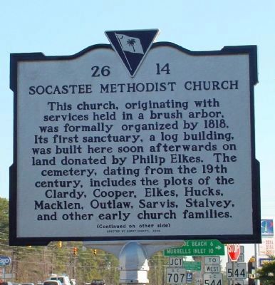
1. Socastee Methodist Church Marker (front)
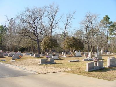
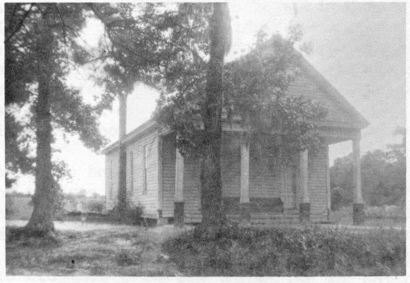
This church, originating with services held in a brush arbor, was formally organized by 1818. Its first sanctuary, a log building, was built here soon afterwards on land donated by Philip Elkes. The cemetery, dating from the 19th century, includes the plots of the Clardy, Cooper, Elkes, Hucks, Macklen, Outlaw, Sarvis, Stalvey, and other early church families.
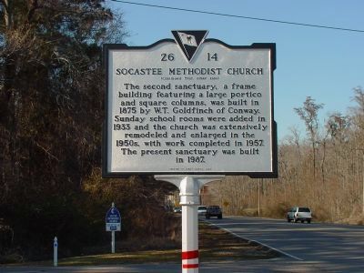
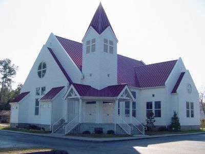
The second sanctuary, a frame building featuring a large portico and square columns, was built in 1875 by W.T. Goldfinch of Conway. Sunday school rooms were added in 1833 and the church was extensively remodeled and enlarged in the 1850s, with work completed in 1957. The present sanctuary was built in 1987.
Erected 2004 by Horry County. (Marker Number 26-14.)
Topics. This historical marker is listed in this topic list: Religion & Religious Structures. A significant historical year for this entry is 1818.
Location. 33° 41.009′ N, 79° 0.098′ W. Marker is in Socastee, South Carolina, in Horry County. It is at the intersection of Dick Pond Road (former Highway 544) and Socastee Boulevard (State Highway 707), on the right when traveling east on Dick Pond Road (former
this page online

Regionally, this marker is on South Carolina’s Grand Strand and in the Pee Dee. It is also in the American South, specifically in the Deep South, and on the Eastern Seaboard. Globally, it is in the North Atlantic Region, North America, the Western Hemisphere, the Western World, and the Anglosphere. Historically, it finds itself in what was once the territory of the Mississippian Culture, one of the original Thirteen Colonies, one of the Confederate States of America, and the Antebellum South.
Other nearby markers. At least 8 other markers are within 4 miles of this marker, measured as the crow flies: Intra-Coastal Waterway (approx. 0.4 miles away); Socastee (approx. 0.4 miles away); The Sarvis House (approx. half a mile away); Command Chief Master Sergeant William D. Forbus (approx. 3.4 miles away); Officers Open Mess (approx. 3½ miles away); NCO Open Mess (approx. 3½ miles away); Visiting Officer’s Quarters (Billeting) (approx. 3½ miles away); The Holocaust (approx. 3½ miles
Photographed by J. J. Prats, February 8, 2007
2. Socastee Methodist Church Marker (reverse)
Photographed by J. J. Prats, February 8, 2007
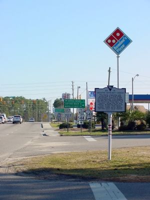
3. Socastee Methodist Church Marker
Photographed by J. J. Prats, February 8, 2007
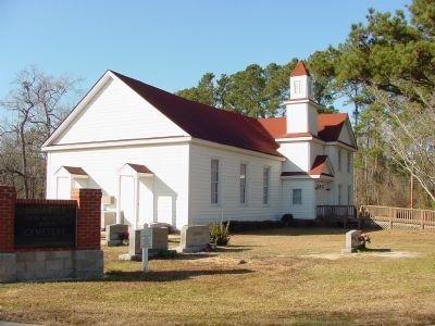
4. Socastee Methodist Church Second Sanctuary
Photographed by J. J. Prats, February 8, 2007
5. Socastee Methodist Church Present Sanctuary
Photographed by J. J. Prats, February 8, 2007
6. Socastee Methodist Church Cemetery
via Horry County Historical Society, unknown
7. The original Socastee Methodist Church building
Credits. This page was last revised on April 22, 2022. It was originally submitted on February 8, 2007, by J. J. Prats of Powell, Ohio. This page has been viewed 2,159 times since then and 31 times this year. Last updated on August 5, 2008, by Brian Scott of Anderson, South Carolina. Photos: 1, 2, 3, 4, 5, 6. submitted on February 8, 2007, by J. J. Prats of Powell, Ohio. 7. submitted on April 22, 2022, by Larry Gertner of New York, New York. • Kevin W. was the editor who published this page.
