Smoke, Coke, Coal, and Kaymoor
New River Gorge
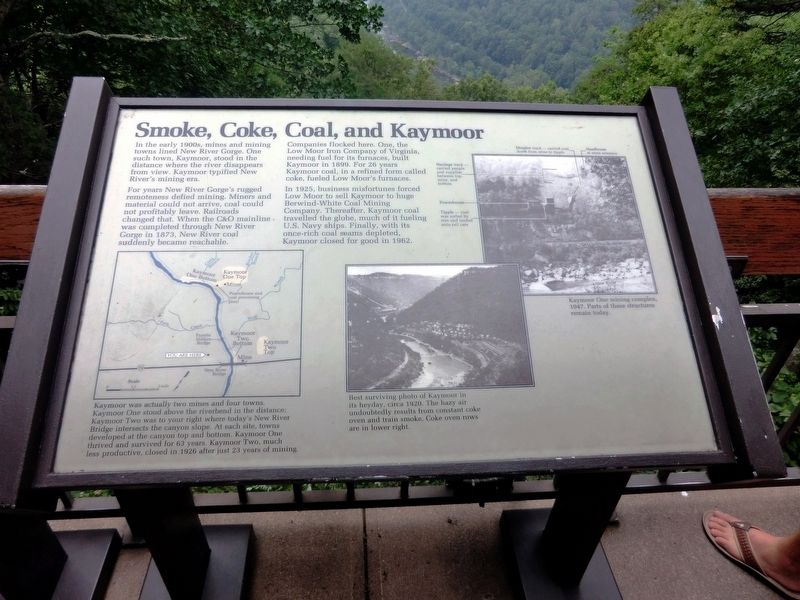
For years New River Gorge’s rugged remoteness defied mining. Miners and material could not arrive, coal could not profitably leave. Railroads changed that. When the C&O mainline was completed through New River Gorge in 1873, New River coal suddenly became reachable.
Companies flocked here. One, the Low Moor Iron Company of Virginia, needing fuel for its furnaces, built Kaymoor in 1899. For 26 years Kaymoor coal, in a refined form called coke, fueled Low Moor’s furnaces.
In 1925, business misfortunes forced Low Moor to sell Kaymoor to huge Berwind-White Coal Mining Company. Thereafter, Kaymoor coal travelled the globe, much of it fueling U.S. Navy ships. Finally, with its once-rich coal seams depleted, Kaymoor closed for good in 1962.
(Inscription under the map on the bottom left)
Kaymoor was actually two mines and four towns. Kaymoor One stood above the riverbend in the distance; Kaymoor Two was to your right where today’s
this page online
(Inscription under the image in the lower center)
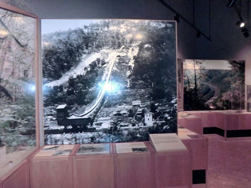
Best surviving photo of Kaymoor in its heyday, circa 1920. The hazy air undoubtedly results from constant coke oven and train smoke. Coke oven rows are in lower right.
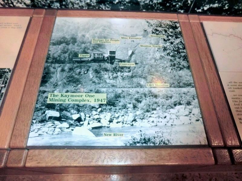
(Inscription under the image in the upper right)
Kaymoor One mining complex, 1947. Parts of these structures remain today.
Erected by National Park Service, U.S. Department of the Interior.
Topics. This historical marker is listed in these topic lists: Industry & Commerce • Railroads & Streetcars. A significant historical year for this entry is 1873.
Location. 38° 4.194′ N, 81° 4.566′ W. Marker is in Lansing, West Virginia, in Fayette County. It is on Visitor Center Road. The marker is on the grounds of the Canyon Rim Visitor Center New River Gorge National River. Touch for map. Marker is in this post office area: Lansing WV 25862, United States of America. Touch for directions.
Regionally,
Other nearby markers. At least 8 other markers are within walking distance of this marker: The Deceptive Forest (a few steps from this marker); New River (a few steps from this marker); New River Gorge Scenic Drives (a few steps from this marker); Industrial Past of the New River Gorge (within shouting distance of this marker); Welcome to New River Gorge National River (within shouting distance of this marker); Trail to Bridge Overlook (within shouting distance of this marker); The Bridge (within shouting distance of this marker); New River Gorge Bridge (about 300 feet away, measured in a direct line). Touch for a list and map of all markers in Lansing.
Credits. This page was last revised on June 14, 2020. It was originally submitted on November 26, 2016, by Don Morfe of Baltimore, Maryland. This page has been viewed 681 times since then and 32 times this year. Photos: 1, 2, 3, 4, 5, 6. submitted on November 26, 2016, by Don Morfe of Baltimore, Maryland. • Bill Pfingsten was the editor who published this page.
