Near Villa Rica in Carroll County, Georgia — The American South (South Atlantic)
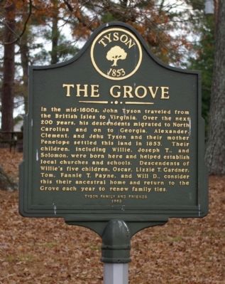
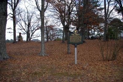
The Grove
Erected 2003 by Tyson Family and Friends.
Topics. This historical marker is listed in these topic lists: Churches & Religion • Colonial Era • Education • Settlements & Settlers. A significant historical year for this entry is 1853.
Location. 33° 40.937′ N, 84° 54.533′ W. Marker is near Villa Rica, Georgia, in Carroll County. Marker is on Tyson Road, half a mile north of Flat Rock Road, on the right when traveling north. Touch for map. Marker is at or near this postal address: 602 Tyson Road, Villa Rica GA 30180, United States of America. Touch for directions.
Other nearby markers. At least 8 other markers are within 5 miles of this marker, measured as the crow flies. Freedom Riders (approx. 3.4 miles away); Thomas Andrew Dorsey (approx. 3.4 miles away); The Mill (approx. 3.4 miles away); Villa Rica Explosion (approx. 3˝ miles away); Bank of Villa Rica (approx. 3˝ miles away); Villa Rica's Textile Industry (approx. 3˝ miles away); Thomas A. Dorsey (approx. 3.6 miles away); Fullerville Jail (approx. 4.4 miles away). Touch for a list and map of all markers in Villa Rica.
Credits. This page was last revised on January 26, 2020. It was originally submitted on August 7, 2008, by David Seibert of Sandy Springs, Georgia. This page has been viewed 1,932 times since then and 63 times this year. Photos: 1, 2. submitted on August 7, 2008, by David Seibert of Sandy Springs, Georgia. • Kevin W. was the editor who published this page.

