Blaine in Grainger County, Tennessee — The American South (East South Central)
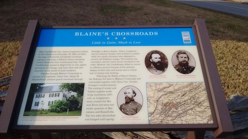
Blaine's Crossroads
Little to Gain; Much to Lose
Passing through Blaine's Crossroads in pursuit of Longstreet, Union Gen. James M. Shackelford's advance guard continued through Rutledge to Bean's Station. There, Longstreet sent an infantry division with artillery to attack, while two cavalry divisions were deployed to prevent the Federals' escape. This assault was successful, and the Union forces retreated in disorder. However, the Confederates failed to mount an effective pursuit because of the extreme fatigue of their men and horses and a critical lack of rations and clothing.
Following the Battle of Bean's Station, the Federals fell back to Blaine's Crossroads and entrenched together with Union Gen. Gordon Granger's reinforcements. The coming of winter and limited supplies made troop movements difficult, so Longstreet's army crossed the Holston River and went into winter quarters at Morristown and Russellville. The two sides skirmished and foraged until spring.
Erected by Tennessee Civil War Trails.
Topics and series. This historical marker is listed in this topic list: War, US Civil. In addition, it is included in the Tennessee Civil War Trails series list. A significant historical date for this entry is November 29, 1863.
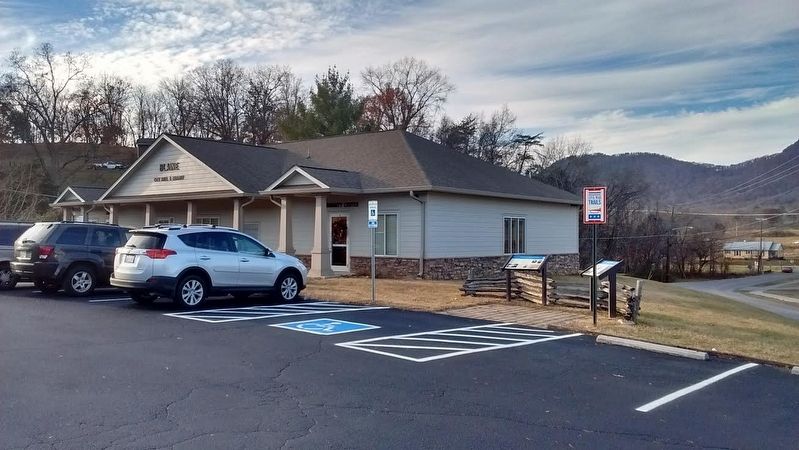
Location. 36° 9.174′ N, 83° 42.021′ W. Marker is in Blaine, Tennessee, in Grainger County. Marker is at the intersection of Indian Ridge Road and Old Rutledge Pike, on the left when traveling north on Indian Ridge Road. Marker is located in the Community Center parking lot. Touch for map. Marker is at or near this postal address: 240 Indian Ridge Road, Blaine TN 37709, United States of America. Touch for directions.
Other nearby markers. At least 8 other markers are within 9 miles of this marker, measured as the crow flies. Janeway Cabin (here, next to this marker); Emory Road (approx. 0.3 miles away); Shields Station (approx. 0.8 miles away); Richland: Birthplace of Albert Miller Lea (approx. 1.6 miles away); Sawyer's Fort (approx. 3 miles away); George Mann (approx. 8.1 miles away); Nicholas Gibbs Homestead (approx. 8.3 miles away); Frances Hodgson Burnett (approx. 8.6 miles away). Touch for a list and map of all markers in Blaine.
Additional commentary.
1. Civil War January 1st ,1864 Blaines Crossroads, TN
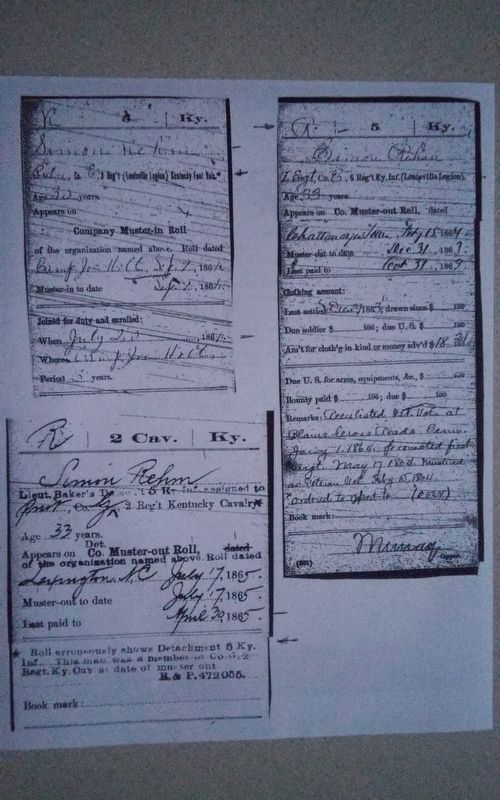
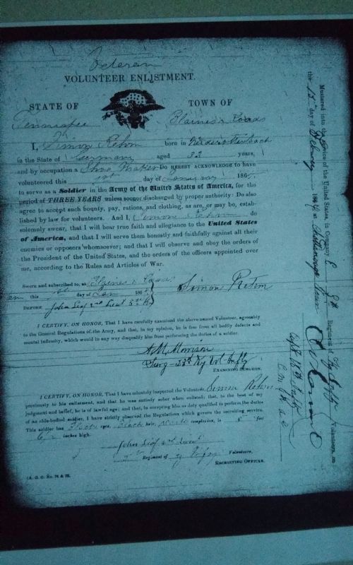
My 2 G grandfather Simon Rehm was in the Union Kentucky 5th infantry, The Louisville Legion. He enlisted at Camp Joe Holt in Indiana in 1861, fought at Shiloh, Stones River, and Chattanooga.Then General Sherman was sent North to help General Burnside defend Knoxville and Simon Rehm was with that Corps. His enlistment ran out during that campaign and he reenlisted as a Veteran Volunteer at Blaines Crossroads. I understand he and several others were given 30 days leave after reenlisting. He was mustered back in at Chattanooga on 15 February 1864 at Chattanooga, linked back up with General Sherman on his March to the Sea. Mustered out July 17, 1865 at Lexington, NC at the end of the WAR in the Kentucky 2nd Cavalry. I found his reenlistment paper in the Kentucky Archives in Frankfort Kentucky.
I will forward a copy to the editor. Note To Editor only visible by Contributor and editor
— Submitted September 20, 2023, by Gerald G Hubbs of Louisville, Kentucky.
Credits. This page was last revised on October 2, 2023. It was originally submitted on December 7, 2016, by Tom Bosse of Jefferson City, Tennessee. This page has been viewed 1,696 times since then and 131 times this year. Last updated on January 13, 2017, by Byron Hooks of Sandy Springs, Georgia. Photos: 1. submitted on December 7, 2016, by Tom Bosse of Jefferson City, Tennessee. 2. submitted on September 20, 2023, by Gerald G Hubbs of Louisville, Kentucky. 3. submitted on December 7, 2016, by Tom Bosse of Jefferson City, Tennessee. 4. submitted on September 20, 2023, by Gerald G Hubbs of Louisville, Kentucky. • Kevin W. was the editor who published this page.


