Downtown Silver Spring in Montgomery County, Maryland — The American Northeast (Mid-Atlantic)
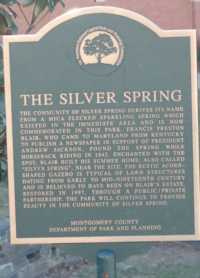
The Silver Spring
Erected by Montgomery County Department of Park and Planning.
Topics and series. This historical marker is listed in these topic lists: Communications • Natural Features • Political Subdivisions • Settlements & Settlers. In addition, it is included in the Former U.S. Presidents: #07 Andrew Jackson series list. A significant historical year for this entry is 1842.
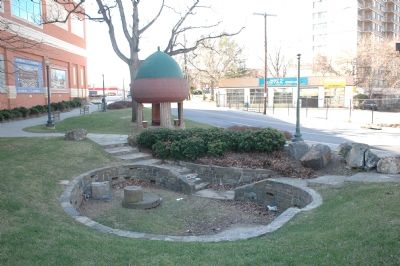
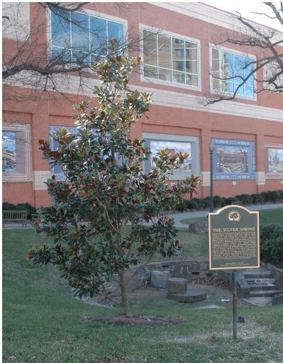
Location. 38° 59.377′ N, 77° 1.744′ W. Marker is in Silver Spring, Maryland, in Montgomery County. It is in Downtown Silver Spring. Marker is on Newell Street near East West Highway (Maryland Route 410). Marker is in Acorn Park. Acorn Park is at the intersection of East West Highway, Blair Mill Road and Newell Street. Touch for map. Marker is in this post office area: Silver Spring MD 20910, United States of America. Touch for directions.
Other nearby markers. At least 5 other markers are within walking distance of this marker. The Community of Silver Spring (a few steps from this marker); Silver Spring Shopping Center (a few steps from this marker); Silver Spring Armory 1914 (within shouting distance of this marker); Silver Spring B & O Railroad Station (within shouting distance of this marker); Early's Raid on Washington (within shouting distance of this marker). Touch for a list and map of all markers in Silver Spring.
More about this marker. The marker has the logo of The Maryland-National Capital Area Park and Planning Commission.
Also see . . .
1. Silver Spring Historical Society. (Submitted on February 5, 2006.)
2. Happy Birthday, Acorn Park. Article in the Takoma • Silver Spring Voice. (Submitted on February 5, 2006.)
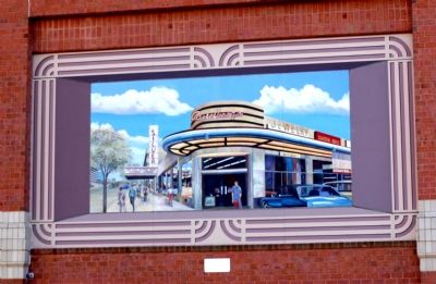
Photographed By Tom Fuchs, January 28, 2006
5. Silver Theatre and Shopping Complex Mural
The plaque beneath the mural reads:
Silver Spring's heyday as a commercial center began in 1938 with the opening of the Silver Theatre and Shopping complex, designed by John Eberson. These streamlined buildings housed a wide variety of shops, as ell as a 1,100 seat movie theatre, and were among the first in the region that were built to accommodate the use of automobiles.
Throughout the 1940s and 1950s, the county's population exploded and Silver Spring grew into a major shopping district with large department stores like Hecht's, J.C. Penney's and Jelleff's. The monumental growth made Silver Spring not only a major suburban community, but also an important economic center for the entire state.
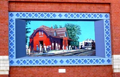
Photographed By Tom Fuchs, January 28, 2006
6. B&O Railroad Station Mural
The plaque beneath the mural reads:
One of the most significant reasons for Silver Spring's growth was its location along the Metropolitan Branch of the B&O Railroad. The railroad line stimulated the development of outlying commuter suburbs. It also allowed the County's agriculture products to be transported to market with greater speed and ease.
The trains began operation on the B&O line in 1873 and the original Silver Spring train station was built in 1878. This ornate building, designed by E. Francis Baldwin, stood until 1945 and was replaced the a station in the Colonial Revival Style.
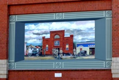
Photographed By Tom Fuchs, January 28, 2006
7. National Guard Armory Mural
The plaque beneath the mural reads:
The first decades of this century saw Silver Spring transformed from a 19th century rural village into an early 20th century residential community and center of commerce. Major E. Brooke Lee and Captain Frank L. Hewitt, returning World War I veterans, were influential in laying out the first subdivisions in Silver Spring during the 1920s and establishing major commercial and civic institutions.
One of the earliest and most substantial buildings to be constructed along Georgia Avenue was the first National Guard Armory. It was built in 1914 for Company K of the 1st Maryland Infantry. It has been remodeled and now houses the Silver Spring Volunteer Fire Department.
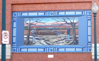
Photographed By Tom Fuchs, January 28, 2006
8. Confederate Raid on Washington Mural
The plaque beneath the mural reads:
Washington, D.C. was raided in 1864 by 14,000 Confederate troops led by General Jubal Early. Skirmishes took place in Silver Spring and Washington, with the attack finally being stopped at Fort Stevens—just a few miles south of this site. Seventeen of the Confederate soldiers killed in this battle are buries at Grace Episcopal Church on Georgia Avenue.
The Confederate officers under General Early made their headquarters at the Blair residence, "Silver Spring", which was ransacked. The nearby home of Montgomery Blair, then Postmaster General of the United States, was burned to the ground.
Photographed By Tom Fuchs, January 28, 2006
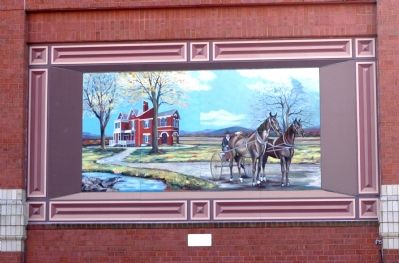
9. Blair House Mural
The plaque beneath the mural reads:
In 1842, Francis Preston Blair built a country house very near this park and divided his time between his 300 acre farm and his city residence "Blair House", which is now the President's official guest house in Washington, D.C. Blair was a powerful newspaper publisher and a friend of President Andrew Jackson.
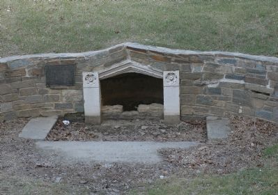
Blair called his estate "Silver Spring", after a beautiful natural spring on the property which bubbled up through mica rock, giving it the appearance of being lined with silver. The town that grew up near Blair's farm became known as Silver Spring.
Credits. This page was last revised on May 25, 2023. It was originally submitted on February 5, 2006, by Tom Fuchs of Greenbelt, Maryland. This page has been viewed 4,454 times since then and 455 times this year. Photos: 1, 2, 3, 4, 5, 6, 7, 8, 9. submitted on February 5, 2006, by Tom Fuchs of Greenbelt, Maryland. • J. J. Prats was the editor who published this page.
