Near Amherst in Amherst County, Virginia — The American South (Mid-Atlantic)
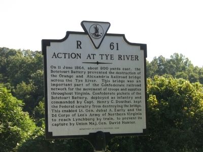
Action at Tye River
Erected 2000 by Department of Historic Resources. (Marker Number R-61.)
Topics and series. This historical marker is listed in this topic list: War, US Civil. In addition, it is included in the Virginia Department of Historic Resources (DHR) series list. A significant historical date for this entry is June 11, 1864.
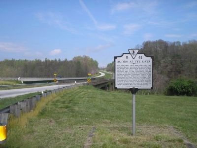
Location. 37° 39.286′ N, 78° 57.677′ W. Marker is near Amherst, Virginia, in Amherst County. Marker is on North Amherst Highway (U.S. 29) south of Ty River Road, on the right when traveling north. Touch for map. Marker is at or near this postal address: 3010 N Amherst Hwy, Amherst VA 24521, United States of America. Touch for directions.
Other nearby markers. At least 8 other markers are within 5 miles of this marker, measured as the crow flies . The Scale House (approx. 0.6 miles away); The Rivers (approx. 2.3 miles away); The Reverend Robert Rose (approx. 3˝ miles away); Grave of Patrick Henry’s Mother (approx. 3.6 miles away); Cabellsville (approx. 3.7 miles away); Hurricane Camille (approx. 4.6 miles away); American Cyanamid (approx. 4.9 miles away); The Virginia Blue Ridge Railway (approx. 5 miles away).
Additional commentary.
1. Old Marker
This marker replaces an older R-61 with the same title, which stood on Highway 29, south of the Tye River Bridge. The old marker read, About 800 yards east, on June 11, 1864, the Botetourt Battery, C.S.A., prevented Federal Raiders from burning the Orange and Alexandria Railroad Bridge, thus enabling General Jubal Early to reach Lynchburg in time to save it from capture by General Hunter.
— Submitted August 15, 2008, by Craig Swain of Leesburg, Virginia.
Credits. This page was last revised on August 15, 2021. It was originally submitted on August 14, 2008, by Laura Troy of Burke, Virginia. This page has been viewed 3,239 times since then and 95 times this year. Photos: 1. submitted on August 14, 2008, by Laura Troy of Burke, Virginia. 2. submitted on September 12, 2008, by Bill Coughlin of Woodland Park, New Jersey. • Craig Swain was the editor who published this page.

