Fall River Mills in Shasta County, California — The American West (Pacific Coastal)
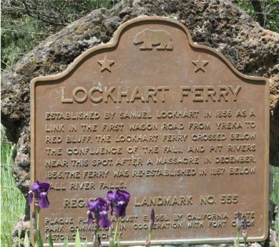
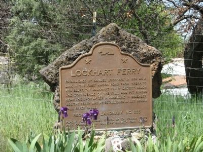
Lockhart Ferry
Erected by California State Park Commission in cooperation with Fort Crook Historical Society, August 5, 1956. (Marker Number 555.)
Topics and series. This historical marker is listed in these topic lists: Landmarks • Notable Places • Settlements & Settlers • Waterways & Vessels. In addition, it is included in the California Historical Landmarks series list. A significant historical month for this entry is December 1856.
Location. 41° 0.144′ N, 121° 26.628′ W. Marker is in Fall River Mills, California, in Shasta County. Marker is on McArthur Road (State Highway 299), on the left when traveling east. Touch for map. Marker is in this post office area: Fall River Mills CA 96028, United States of America. Touch for directions.
Other nearby markers. At least 4 other markers are within 8 miles of this marker, measured as the crow flies. Glenburn Community Church (approx. 4.7 miles away); Captain Dick and Richard Pugh (approx. 7 miles away); Fort Crook (approx. 7 miles away); Site of the First School in Fall River Valley (approx. 7.3 miles away).
Credits. This page was last revised on June 16, 2016. It was originally submitted on August 15, 2008, by Syd Whittle of Mesa, Arizona. This page has been viewed 1,778 times since then and 35 times this year. Photos: 1, 2. submitted on August 15, 2008, by Syd Whittle of Mesa, Arizona. • Kevin W. was the editor who published this page.

